Join William Thomson on his journey each month exploring a Shipping Forecast region.
Humber is one of 31 regions in The Shipping Forecast, a broadcast that has been providing weather information to mariners for the past 150 years. Like many things, there was a spark that ignited it – in this case, the ‘Royal Charter Storm’ of 1859, which claimed the lives of 800 people around the British Isles – 450 of whom were on the steam clipper ship Royal Charter.
She was one of the fastest and most famous emigrant ships on the Australian route and was at the end of a two-month voyage from Melbourne. After safely navigating a long ocean voyage full of perils, they were in sight of land when disaster struck.
It was autumn and the storm had intensified over the previous days, hitting Cornwall in the afternoon of October 25 and moving north to Anglesey, with 100mph winds battering the Royal Charter as she approached her destination, Liverpool. The seas were so rough that the pilot boat couldn’t reach them, so the captain made the decision to anchor offshore.
However, in hurricane-force winds the port anchor chain parted at 1:30 in the morning, followed by the starboard chain an hour later. In a desperate attempt to stop the ship dragging onto the lee shore of Anglesey, the crew cut down her masts – but even with the engines on full power she couldn’t make headway against the storm. The inevitable followed; she was swept onto the rocky coastline and battered to pieces by massive waves. Nine out of ten people on board died.
If the captain had access to even a basic forecast, he would have taken shelter in Holyhead and waited for the worst of the weather to pass. But without the forecast he had no idea whether conditions would improve or deteriorate, whether the winds would back or veer. So he carried on and took his ship into a mariner’s hell; drifting powerlessly onto a lee shore.
This is a coastline in which the wind is blowing onto the land, making inshore waters rough and pushing your boat towards the rocks. This is the opposite of when you have offshore winds, making calm seas close to shore and pushing you out to the safety of deep water if you drag your anchor (or the chain breaks) in strong winds.
No coastline is ever always a lee shore – it depends on the wind direction, which is always changing. This is why the Shipping Forecast is so valuable; no one place is inherently safe or dangerous – it depends on the conditions at the time, which is what the forecast tells you.
And even when your boat has complete electrical failure, all you need is a simple battery-powered LW radio that picks up the signal everywhere around the British Isles, in all weather conditions.
The most vital piece of information the Shipping Forecast warns you of is that dreaded lee shore, helping you select somewhere to anchor where the wind is blowing off the land, which ideally also shelters you from the swell. In those conditions you can sit snug even in a gale – but if the winds shift; if they ‘back’ or ‘veer’, you want to get out before it becomes untenable and your peaceful anchorage turns into a raging lee shore like the Royal Charter was wrecked upon.
At the time of the Royal Charter storm, Admiral Robert Fitzroy was in charge of what we now call the Met Office. He was a visionary man dedicated to his duty and saw that the disaster could have been averted if the ship’s captain had access to a forecast, so he set himself the task of establishing a system whereby live weather information could be sent to him from stations and ships around the British Isles, processed into a clear picture of what’s going to happen in the next 24 hours, from which he could send out warnings to regions where gales were anticipated.
It sounds simple today, but required an innovative juxtaposition of the most technologically advanced systems available at that time. We’ll explore how he achieved this in more detail next month, but for now let’s get to know Humber a little better.
Humber. South 4 to 5, backing south-east 4 later. Slight to moderate. Rain, then showers. Poor, occasionally very poor.
What does this mean?
The first word to pick up on is ‘backing’. If you imagine looking down at a wind map from above, backing means there will be an anti-clockwise wind shift (like a clock hand going back), with winds originally from the south backing around to the south-east. When you’re on the beach or at sea and you’re facing into the wind, a ‘backing’ wind will be moving around to the left.
The Force 4 winds are perfect for many sailors, ranging between 11-16 knots. This is enough to give you some good speed but also keep things comfortable onboard. There may be small waves and white horses, giving a sensation of excitement and adrenaline without being scary.
The gentle conditions are reinforced by the ‘slight or moderate’ sea state, with moderate waves growing no more than 2.5 metres and slight waves being just 0.5 metres. All in all, the wind and waves are looking nice – but watch out for visibility! ‘Occasionally poor’ means you may only be able to see 1,000m, which is not too comforting in a busy estuary like the Humber.
What are the conditions for Humber today? Tune into the Shipping Forecast at 0048, 05:20, 12:01 or 1754 to find out!
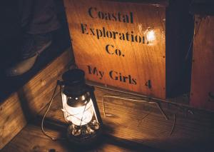
You can enjoy your very own Swallows and Amazons adventure. Credit: The Coastal Exploration Company
THE COASTAL EXPLORATION COMPANY
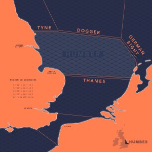
The Humber Shipping Forecast region covers the east coast of Britain from 54°15’ N (just south of Scarborough) to 52° 45’ N (Horsey Gap in Norfolk). These co-ordinates are measurements of latitude, your position in degrees (°) and minutes (‘) north of the equator.
One minute of latitude is equal to one nautical mile, and there are 60 minutes in a degree, so if you sail due north for one degree of latitude you will cover 60nm, which is 69 land miles and 111km.
This conversion of degrees into distance is vital for navigators getting a sense of scale; with some simple maths you can work out that the difference between the northern and southern border of the Humber region is 1 degree 30 minutes, which is 90 nautical miles. At an average sailing speed of 4 knots, that would take almost 24 hours to cover.
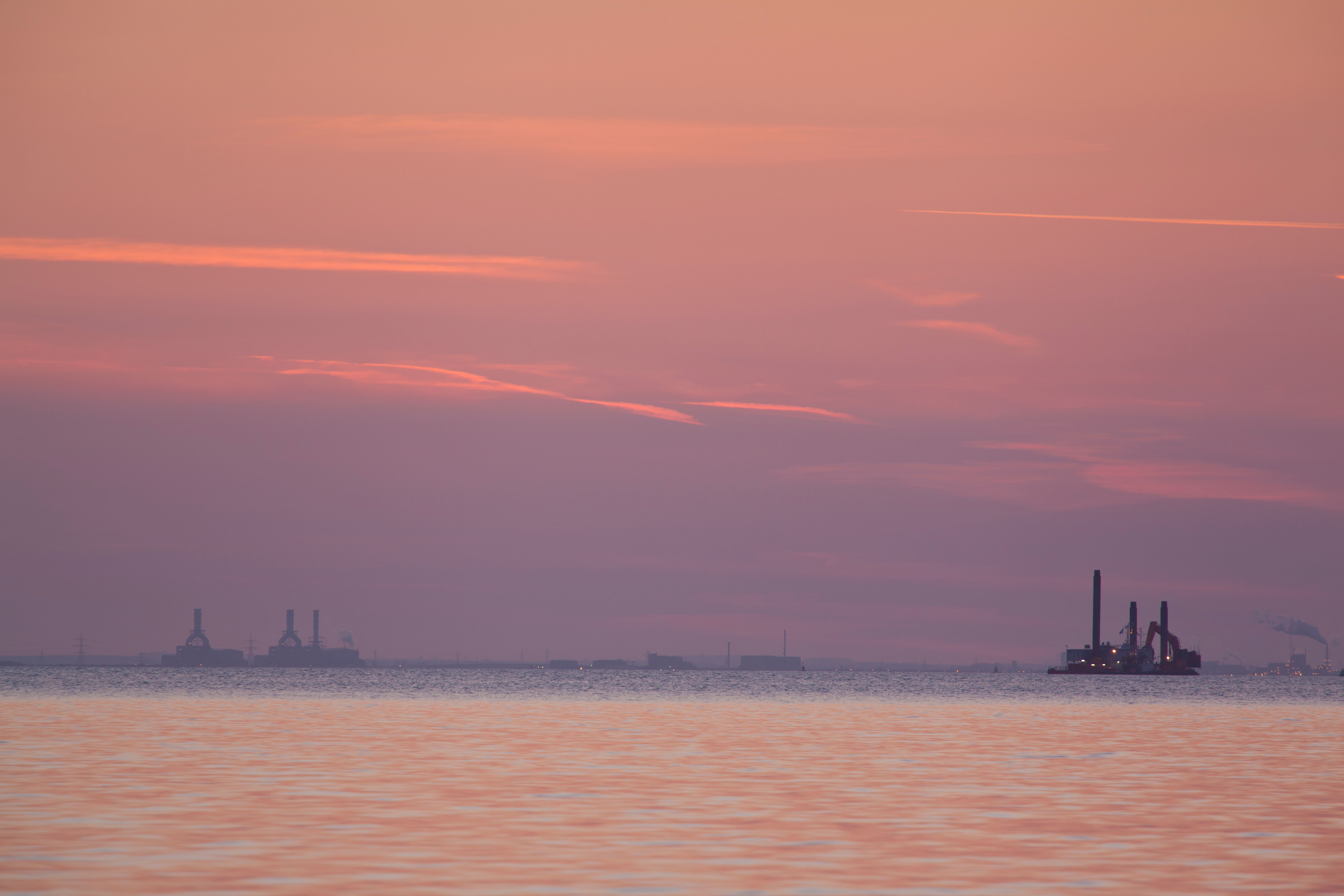
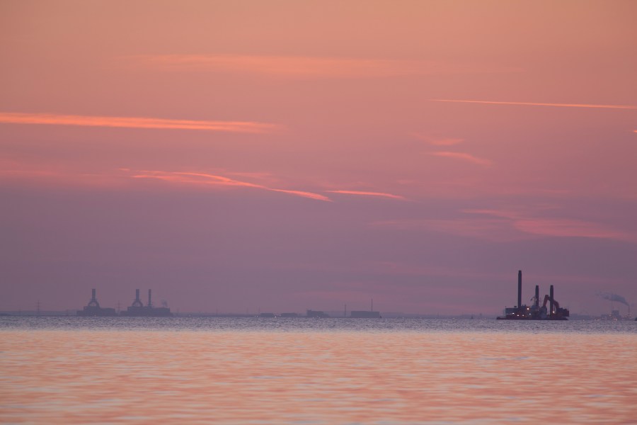
Within this area that extends far out into the North Sea, there are two major sheltered refuges for the mariner; the Humber Estuary and the marshes of North Norfolk. They both have very different characters and as a result different communities have evolved, each one perfectly suited to the environment.
The Humber, with its wide estuary and deep waters, is perfect for large industry and big ships. In contrast, the shallow marshes of North Norfolk are better for small-scale industries with shallow-draught boats that can easily dry out when the tide goes out.
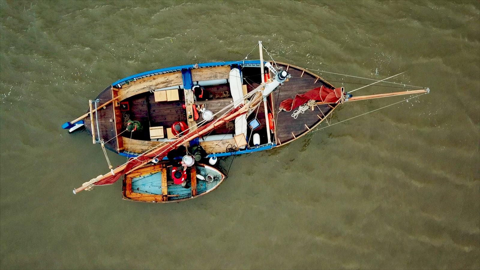
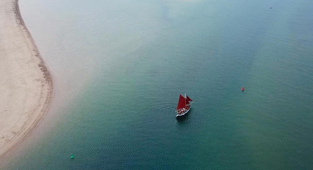
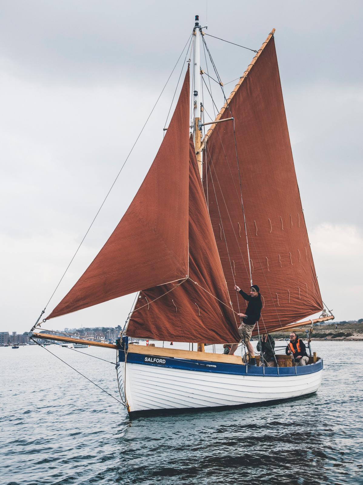
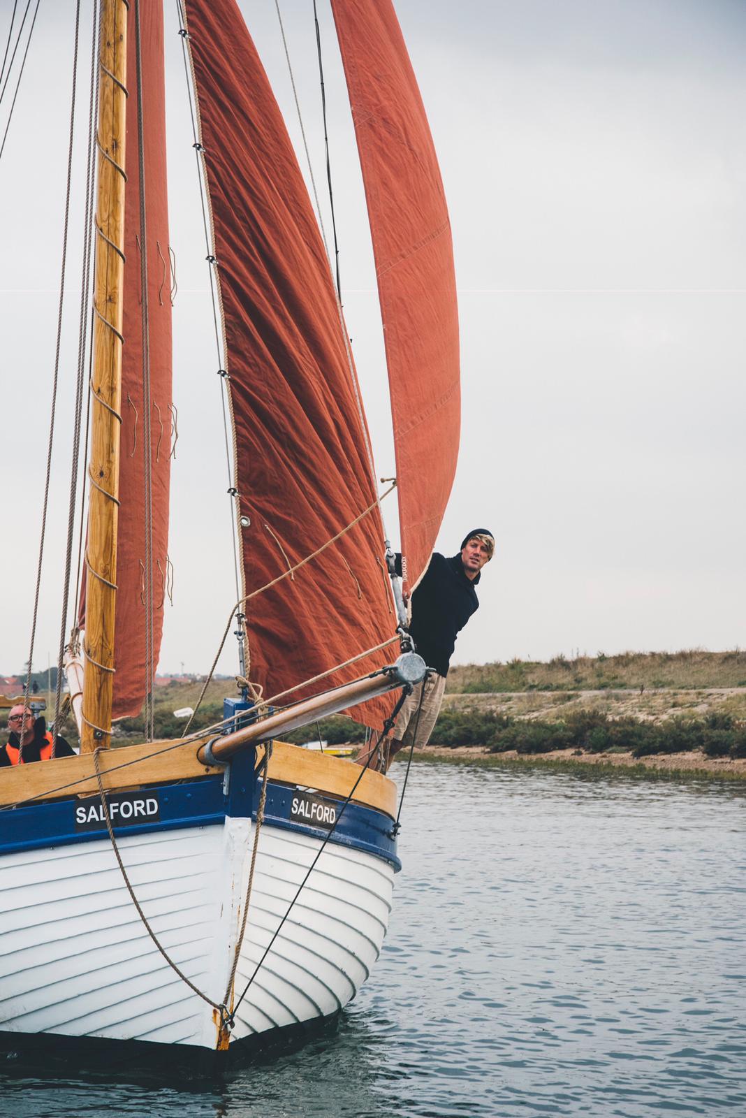
One group of seafarers making use of this symbiosis between boats and their seascape is The Coastal Exploration Company (CEC), based out of Wells-next-the-sea in Norfolk. With a fleet of classic boats, all built locally, they can take you out in the marshes to ‘recharge in nature’, their perfectly apt slogan.
Their smallest lug-rigged mussel flat boat is just 16ft, making it perfect for you exploring the smallest creeks where bigger boats can’t go.
If you want to increase your range, Salford is a 30ft whelk boat built in Kings Lynn in the 1950s and is perfect for coastal cruising across the wash towards and the Humber. CEC equips her with a canvas tent and log burner, perfect for overnighting on a desert island for your very own Swallows and Amazons adventure.
Staying true to the heritage of trade in the Humber region, CEC’s founder Henry Chamberlain has recently invested in a larger smack for sail-powered carbon-free cargo delivery throughout the region and across the channel. Last year, they teamed up with the deep-ocean sailing ship Gallivant who brought olive oil across the Bay of Biscay from Portugal.
Because the ship has a deep draught, The Coastal Exploration Company unloaded to cargo in deep water and transported it through the inland waterways all the way to Norwich – proving that we don’t need to live in a world where heavily polluting ships transport products wrapped in plastic. Instead, we can use nature’s energy to find a new balance and create a sustainable future. Watch this space for sail-powered cargo ships; they’re coming to a sea near you!
Check out William Thomson’s shipping forecast for The Hebrides here.