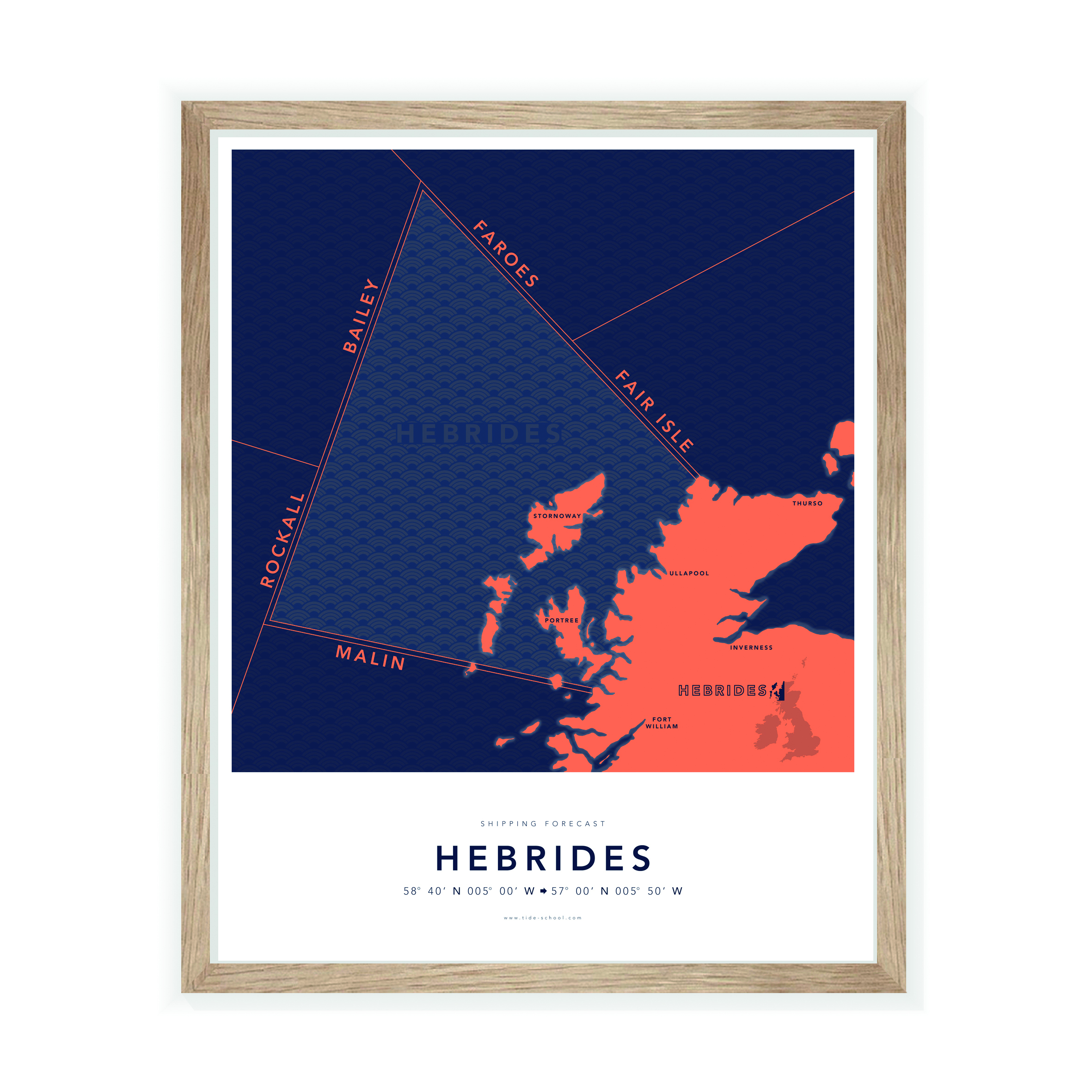
Join William Thomson on a journey exploring the iconic Shipping Forecast region Hebrides.
Welcome to a brand new series I will be writing for Coast over the coming year; the Shipping Forecast! Each month we are going to explore a different region – such as Hebrides, Tyne, Wight, Malin – getting to know that place a little better while diving deep into the essence of this integral feature of British culture.
For example, what does it actually mean when the reader poetically broadcasts in their soothing voice: “Hebrides. South east veering south west 4 or 5, moderate, occasionally poor.” What does it feel like to be in those conditions, pitching and tossing in a small vessel off the rocky shore on a moonless night?
Inherently, the Shipping Forecast is an emotional masterpiece that conjures up the majesty, beauty, fear and awe that mariners around Britain experience on a daily basis. When it was created by Admiral Fitzroy (more about him next month) in the 1860s, the motivation was to keep seamen safe.
However, Fitzroy had a gut feeling that the public would also appreciate the information, so he organised for the weather data to be made readily available. He was right about public interest; every day, hundreds of thousands of listeners tune into the Shipping Forecast – far less than those who actually use it to stay safe at sea.
There are many reasons why we love the Shipping Forecast, the most common being that it gives us a sense of stability in a chaotic world full of change. It is the daily equivalent of the infamous ‘Keep Calm and Carry On’ poster.
Except for the world wars, the forecast has been broadcast daily for 150 years, to the same format at the same times of day. It is the anchor that weathers the storm of change, reassuring us that life goes on and everything is probably going to be okay. The 0048 edition is especially soothing, calming many people down after a high-stress day and resetting their systems for more of the same tomorrow.
You can just imagine all those people around the British Isles tucked up in bed, slowly dozing off to Ronald Binge’s Sailing By, followed by the reassuringly familiar “And now for the Shipping Forecast, issued by the Met Office on behalf of the Maritime and Coastguard Agency at 0048 hours today.”
What follows is a genius work of art, a mixture of carefully selected words that paint a picture of the dynamic waters around our island. In the deepest depths of winter, far offshore somewhere in Hebrides, you’ll be given a glimpse of monstrous seas and terrifyingly powerful winds. And here lies what I believe to be the true allure of the Shipping Forecast; it makes us grateful to be ‘in here’, tucked up safely in bed, rather than ‘out there’, wondering if you’ll see another sunrise.
Notwithstanding the emotional allure of the Shipping Forecast, it is inherently practical and this is what we will be exploring over the next 12 months, helping you better understand the British coastline.
But with all the information we can access on our smartphones, is the forecast still relevant today? I would say yes – you can never have too much information when it comes to better understanding sea conditions; every forecast is slightly different and one may highlight something vital you missed in the other, like reduced visibility or an change in the swell.
By bringing together information from several sources you are able to deepen your understanding of what’s happening around you – and perhaps more importantly – what is going to happen next.
But before we get too far ahead, we should start with the basics and train ourselves in the unusual language of this Radio 4 broadcast, understanding the exact nautical meaning of words like “soon, severe gale, mixers are, slowly, rising quickly, become cyclonic, backing”.
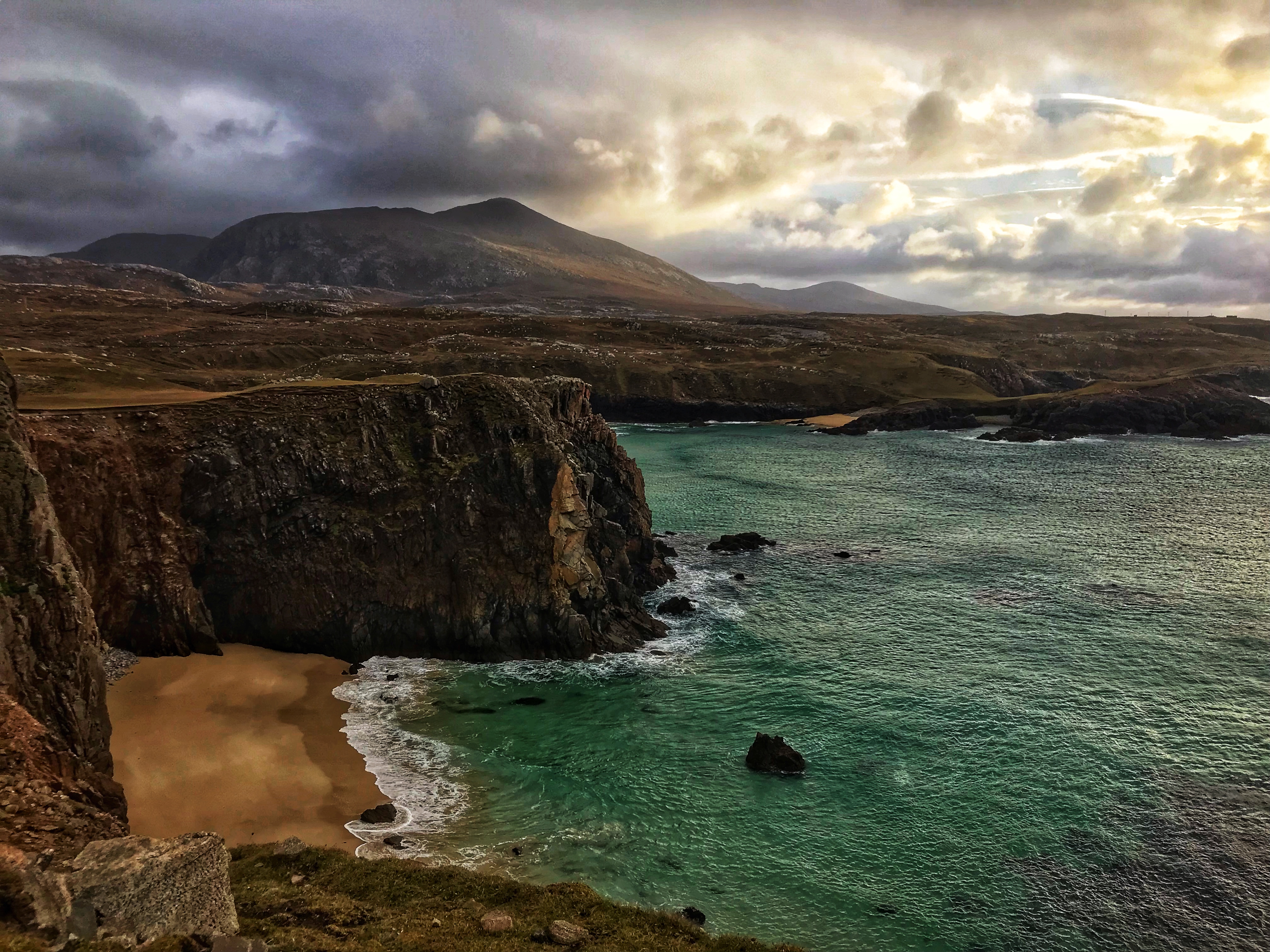
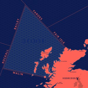
Once we’ve mastered this, we can bring the elements together; the shape of the coastline, direction and strength of winds, size of seas, to create a clear picture of what that actually looks and feels like when you’re in the water. And to start, we’re going to start with Britain’s wildest corner – Hebrides.
Hebrides. West 4 to 5, occasionally 6 at first, then perhaps near gale 7 later. Moderate or rough, occasionally very rough in the west. Thundery showers. Good, occasionally poor.
What does this look like?
If you were out at sea in the Hebrides off Scotland’s west coast, you’d be in for a rocky ride. A near gale, Force 7, experiences winds of 28-33 knots and is described as sea heaps up and white foam from breaking waves begins to be blown in streams along the direction of the wind. The sound of that strength wind whistling through your rigging makes hearing people difficult and you may need to speak loud and slow to be heard properly above the tumult.
‘Moderate or rough’ refers to the waves. Rough is classified as waves between 2.5m and 4m, which is around the height of a bungalow. But in the west you will find it ‘very rough’ with waves the size of a two-storey building, growing up to 6m in height.
Coming from the west, like the wind, means you would want to head to the east of the islands in the Hebrides to find shelter, in the ‘lee of the land’. Nestled in there, you’ll be protected from the swell crashing on the west side and because the winds will be offshore, the sea will be considerably calmer.
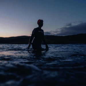
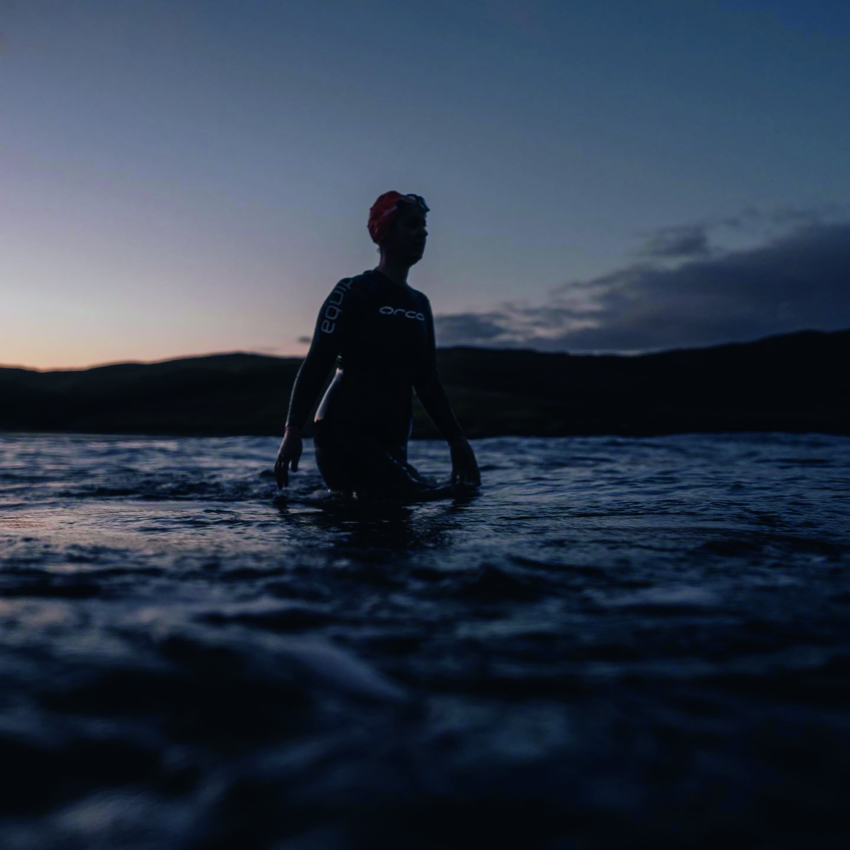
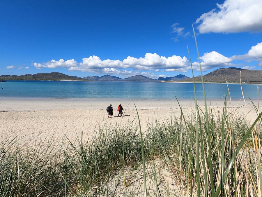
‘What makes swimming so unique here is that we are at the mercy of the weather windows, so there’s a sense of making the very most of every moment’. Credit: Brett Currie
Sea swimming in the Hebrides
For much of the 20th century, children on the Hebridean island of Lewis were taught not to go swimming. “Don’t go in the sea,” Immerse Hebrides founder Norma MacLeod was told over and over again.
This ingrained cultural fear of the ocean stemmed from a terrible tragedy on New Year’s Day in 1919, when a troop ship carrying 250 soldiers from the First World War ran aground just off the island, resulting in the deaths of 212 men. Having survived four years of war, the islands’ remaining young men were taken by the sea, within sight of their families.
The Iolaire tragedy had a huge impact on islanders’ perception of the sea – but, on the flip side, the health benefits of cold water immersion, crystal clear visibility and dramatic seascapes drew triathlete Norma in. Three years ago she handed in her notice as a nurse and founded a swim touring business on the island. As she explains: “It’s perfect being based here on Lewis, because whatever direction the wind and swell are coming from, there’ll be somewhere sheltered on the island.”
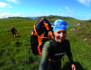
The health benefits of cold water immersion, crystal clear visibility and dramatic seascapes are a huge draw for Norma MacLeod. Credit: Immerse Hebrides
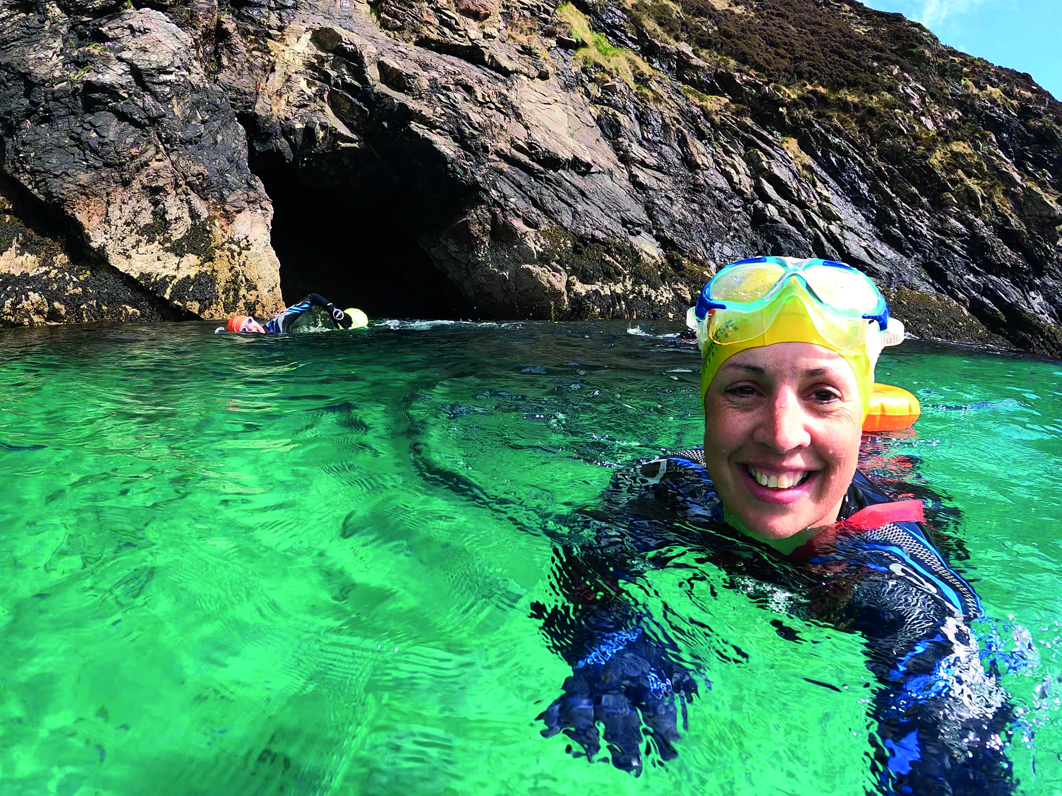
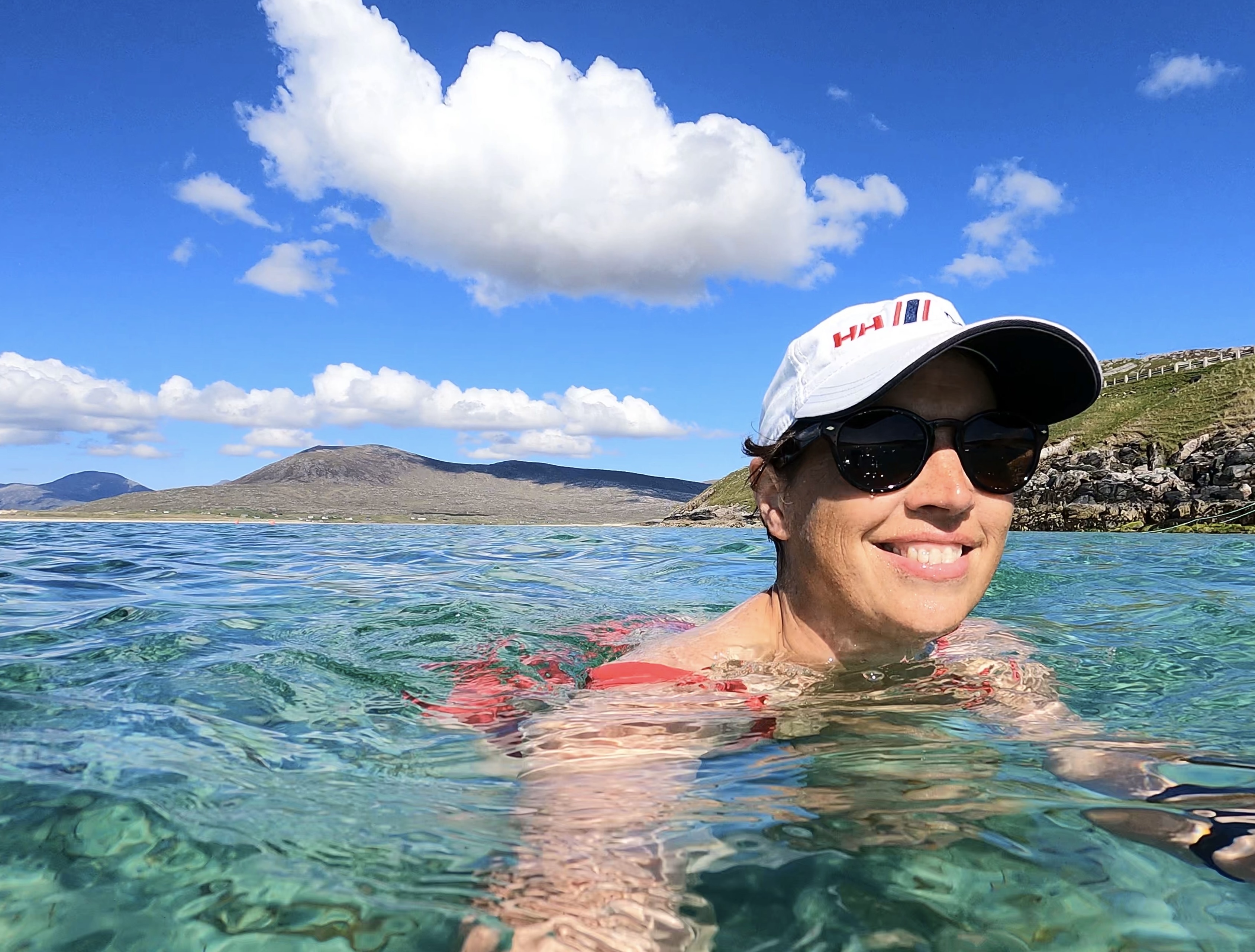
For many, the idea of swimming in the Outer Hebrides may seem a bit mad. They are probably right – but mad can be great. Despite its near-Arctic latitude, Lewis is a world-class wild swimming destination that blends spectacular scenery with sublime wildlife and unbelievable water visibility.
You won’t find anywhere else like it on earth. “There’s a kelp forest we swim over where the depth is 20 metres and you can see all the way down to the bottom, where the kelp is gently swirling in the current. It’s amazing,” adds Norma.
She set up Immerse Hebrides when there were only a handful of swimmers on the island. “I thought our main customers would be triathletes like me, but most of them are actually casual dippers who just want the experience of being totally immersed in nature,” she reveal.
Guests come for anything from a weekend to a week, swimming in the best spots determined by the wind and tide. As Norma concludes: “What makes swimming so unique here is that we are at the mercy of the weather windows, so there’s a sense of making the very most of every moment because we know it won’t last long and may never come again. That makes every swim feel incredibly special.”
Go sea swimming with Immerse Hebrides: immersehebrides.com
Instagram: @immersehebrides
Facebook: Immerse Hebrides
Check out more photos of the Hebrides by Brett Currie at www.brettcurrie.com