Sophie Pierce and Matt Newbury, authors of new book Wild Swimming Walks: Dartmoor and South Devon, share their favourite walks with a wild swim spot on the south Devon coast
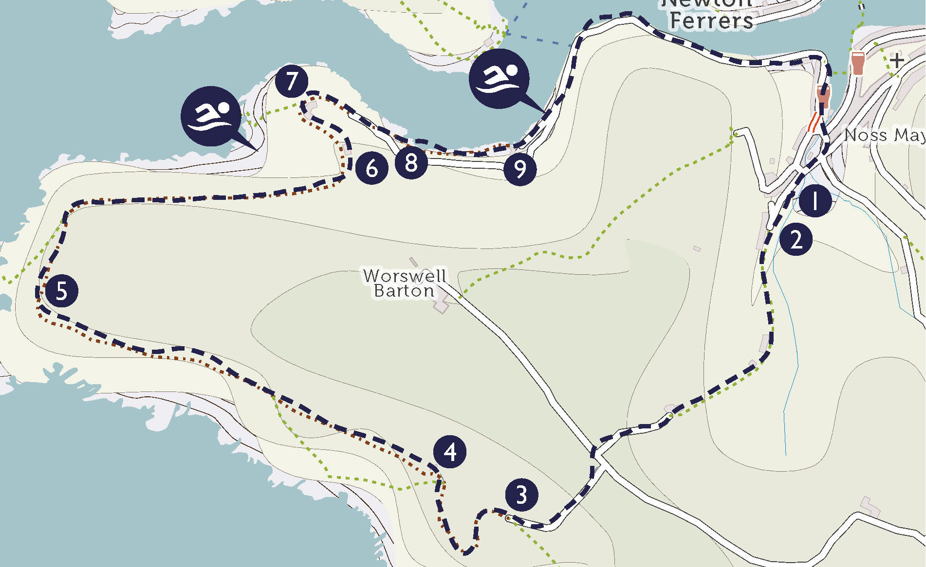
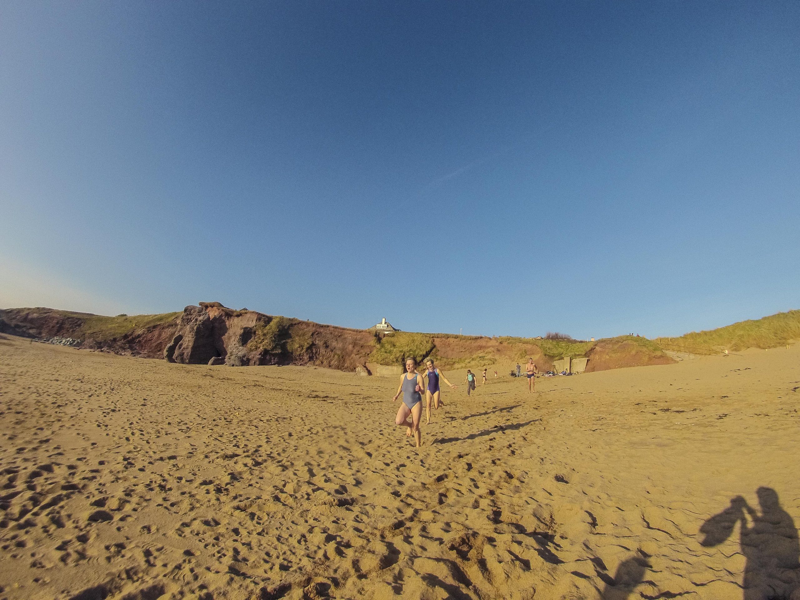
CELLAR BEACH CIRCULAR
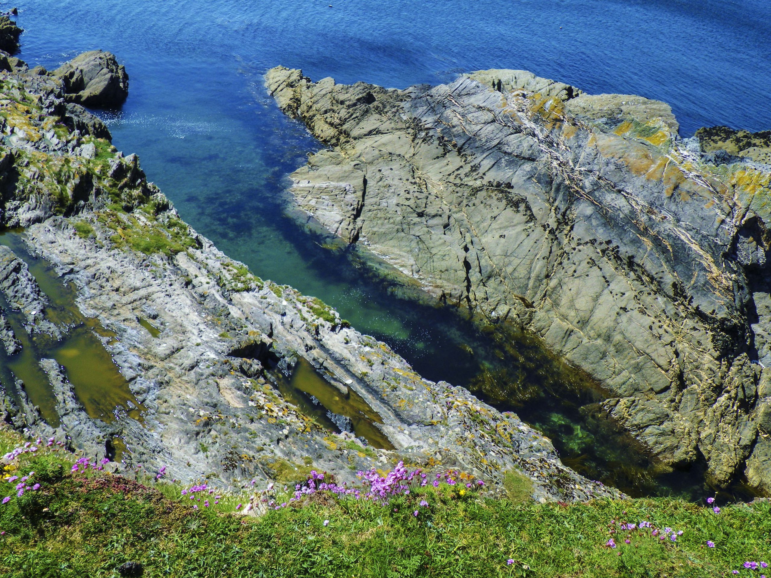
This is a simply gorgeous walk and swim, taking in huge and rugged cliffs, with vertiginous and far-reaching views, as well as the softer scenery of the Yealm estuary.

INFORMATION
Distance: 4.5 miles
Time: 2 hours
Map: OS Explorer South Devon OL20
Start Point: Car park by the tennis courts in Noss Mayo (PL8 1EH, SX 547 474)
End point: Car park by the tennis courts in Noss Mayo
Public transport: Number 94 Bus from Plymouth. Mon-Sat
Swimming: Cellar Beach (SX 531 475) River Yealm estuary at Kilpatrick Steps (SX 540 477)
Places of Interest: Revelstoke Drive, Cellar Beach which is sandy at low tide
Refreshments: The Ship Inn, Noss Mayo has a lovely setting overlooking the harbour with wooden floors and log fires in winter. It also has fun, clear ‘pods’ you can sit in outside, enjoying the views while staying warm (01752 872387, PL8 1EW). Also the Swan Inn (01752 872392, PL8 1EE). At low tide you can walk across to the Dolphin Inn in Newton Ferrers (01752 872007, PL8 1AE)

DIRECTIONS
1. From the car park, turn left up the lane, with the houses on your right. (0.1 miles)
2. The lane turns into a track. There is a sign saying No Through Road; keep following the track. (0.5 miles)
3. After about 20 minutes the path hits a road, you will see a gate straight ahead with a sign saying Coastal Footpath and Worswell Farm. Turn left along the road and soon right by a car park. There is a sign saying Public Footpath / Coast Path. You get to a gate which says Keep Dogs Under Control – go through here, turn right and follow the coast path west with the sea on your left. (0.5 miles)
4. Follow the path past Warren Cottage, and keep going. (0.7 miles)
5. Follow the path around the headland at the mouth of the estuary and follow it into the woods with the estuary on your left. (0.2 miles)
6. Once out of the woods, you pass a valley with fields and a stream on your left, and then get to some cottages on your right. (0.5 miles)
7. It is easy to miss the turning down to Cellar Beach. It’s on the left, opposite a large Arts and Crafts style house, which has a weather vane with a ship on it. There is a small wooden sign with the yellow National Trust acorn on it, saying Cellar Beach. Take this left hand turning off the main path and follow it down to the beach. (670 ft)
8. Coming back up from the beach, turn left at the Arts and Crafts house and follow the path. Just past the gate and a parking area on the left, there’s a path to the left going down into the woods. Take this path. (0.2 miles)
9. Follow the path behind the cottages and the Toll House and past Kilpatrick Steps (another swim spot). Keep going and you will pick up a road which takes you along the estuary and back to the village. (1.1 miles)
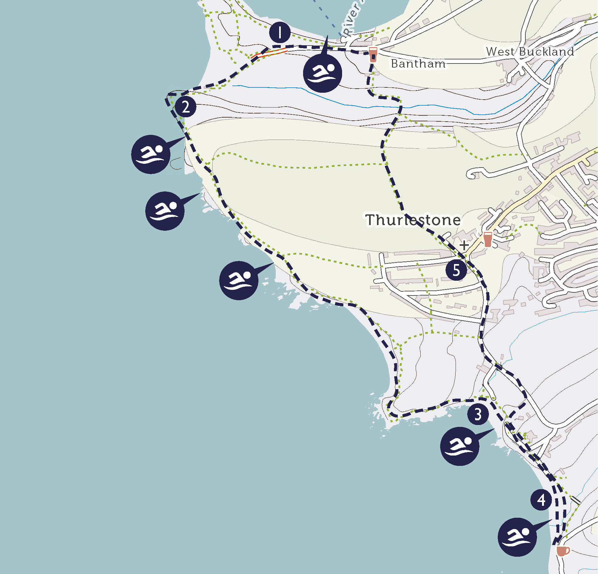
BANTHAM TO THURLESTONE CIRCULAR
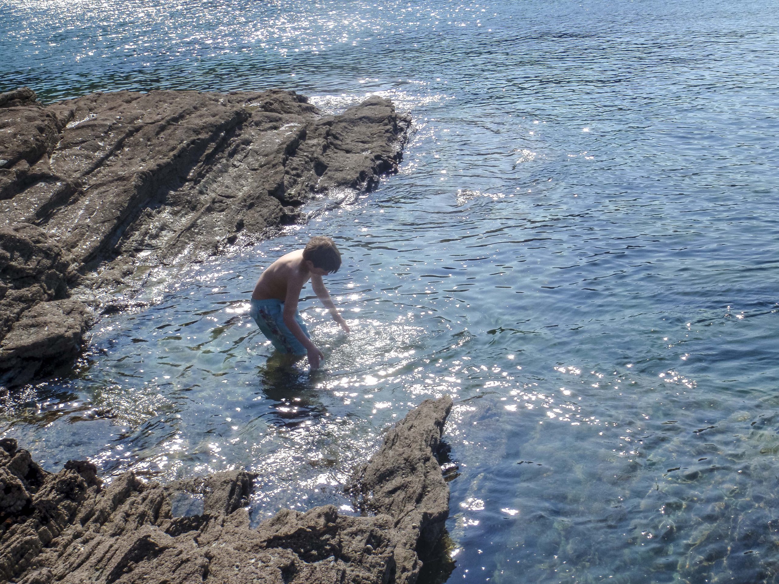
This short walk takes in abundant wildlife, magnificent cliff-top views and a selection of beaches perfect for dippers or more serious swimmers.

INFORMATION
Distance: 4 miles
Time: 3–4 hours
Map: OS Explorer South Devon OL20
Start Point: Bantham car park (SX 663 436, TQ7 3AN)
End point: Bantham car park
Public transport: Seasonal passenger ferry to Bigbury. Nearest train stations are Totnes (17 Miles) or Ivybridge (14 Miles). There are no buses to Bantham, but you can reach Thurlestone on the 162 Tally Ho! service which runs from Kingsbridge
Swimming: Bantham Sands (SX 662 437), South Milton Sands (SX 676 417), Leas Foot Sand (SX 673 421)
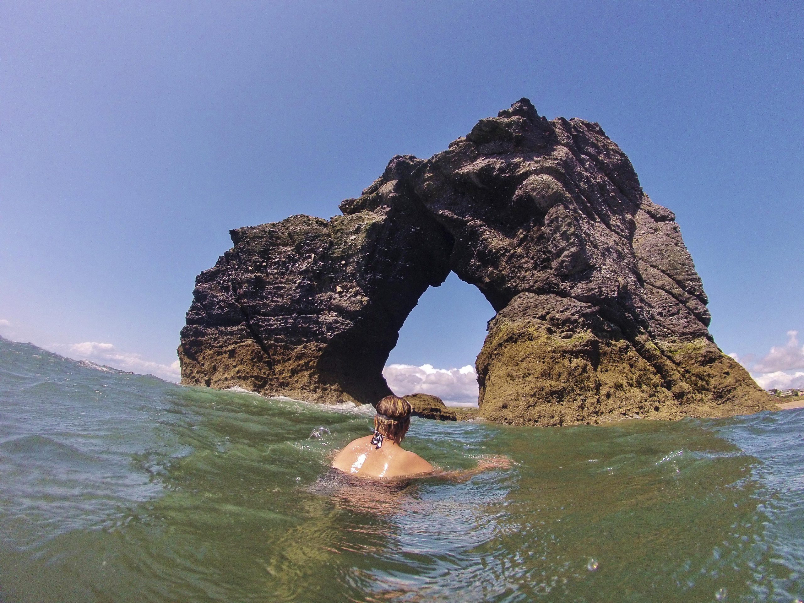
Places of Interest: Bantham Village, Thurlestone Village, Thurlestone Arch
Refreshments: The Beach House at South Milton Sands does amazing seafood but is always busy so best to book (01548 561144, TQ7 3JY). The Sloop at Bantham is a comfy pub with good food (01548 560489, TQ7 3AJ). You can also eat at the Village Inn in Thurlestone which makes a good stop ¾ of the way round (01548 563525, TQ7 3NN), and there is the brilliant Gastrobus in the car park at Bantham which does a great line in quality ‘fast food’ (07592 811277, TQ7 3AN)

DIRECTIONS
1. From the bottom left hand corner of Bantham Sands car park take the road towards the beach and the Surf Life Saving Club, forking left at the bottom to go through the kissing gate and onto the South West Coast Path. It is signed for Thurlestone. Climb the slope and follow the path up to the point. (0.3 miles)
2. Follow the path along the cliff top. You go past several beaches which are swimmable, and then past the golf course on your left. (1.4 miles)
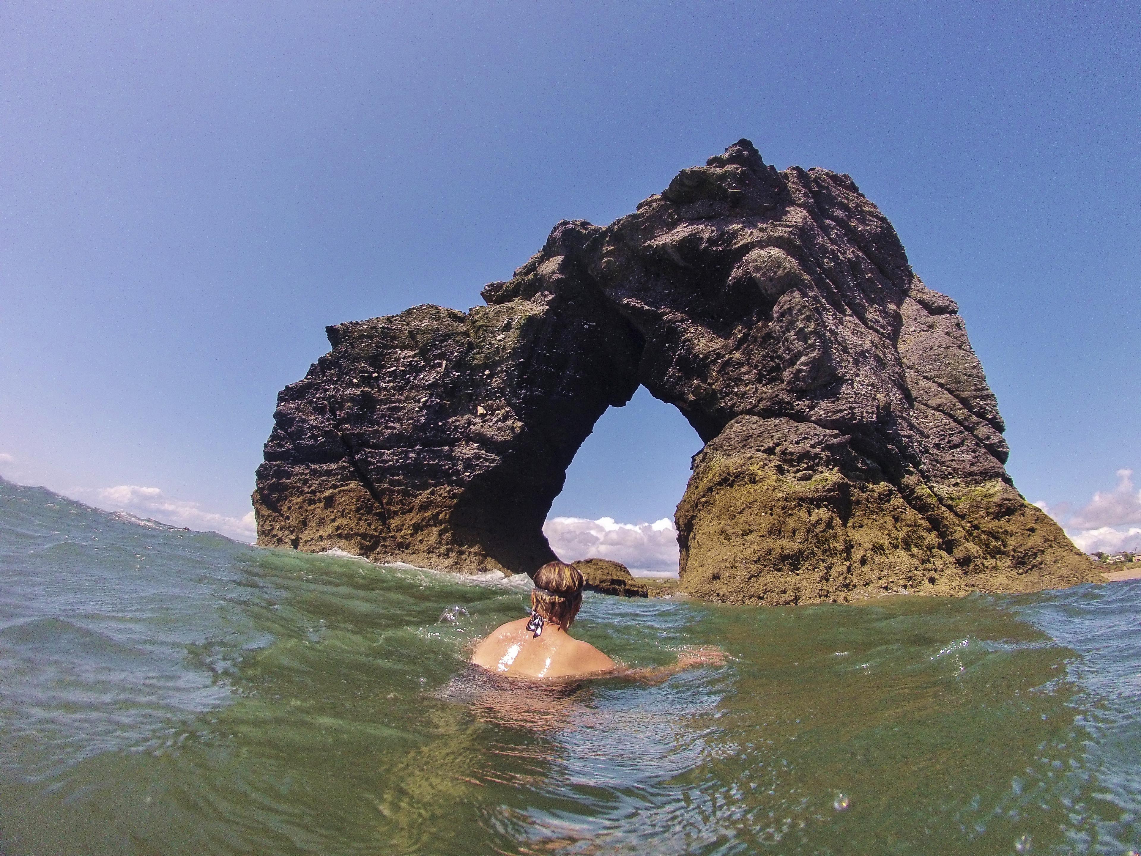
3. At Leas Foot Sand keep going along the coast path with the sea on your right, past the large block of apartments and then down to South Milton Sands for a swim and picnic. On a calm day and at high tide, some swimmers like to try and swim through the rock arch. The arch also marks the end of a reef that runs parallel to the shore which is great for snorkelling. (0.3 miles)
4. From South Milton Sand, return to the start of Leas Foot Sand and then turn right up the sand path, through the overflow parking field and left into the main golf club car park. Continue up onto the road to Thurlestone past the golf club and tennis courts on your left. Continue up the hill to the war memorial, perhaps pausing in the village for refreshments. (0.9 miles)
5. At the war memorial leave the road and continue straight on along a track signed Public Footpath Bantham 3/4 mile. Follow the waymarked path through several fields before descending steeply into the valley. After two stiles you will eventually come out onto the lane in Bantham, near the Sloop Inn. Follow the lane back down to the car park. (0.9 miles)
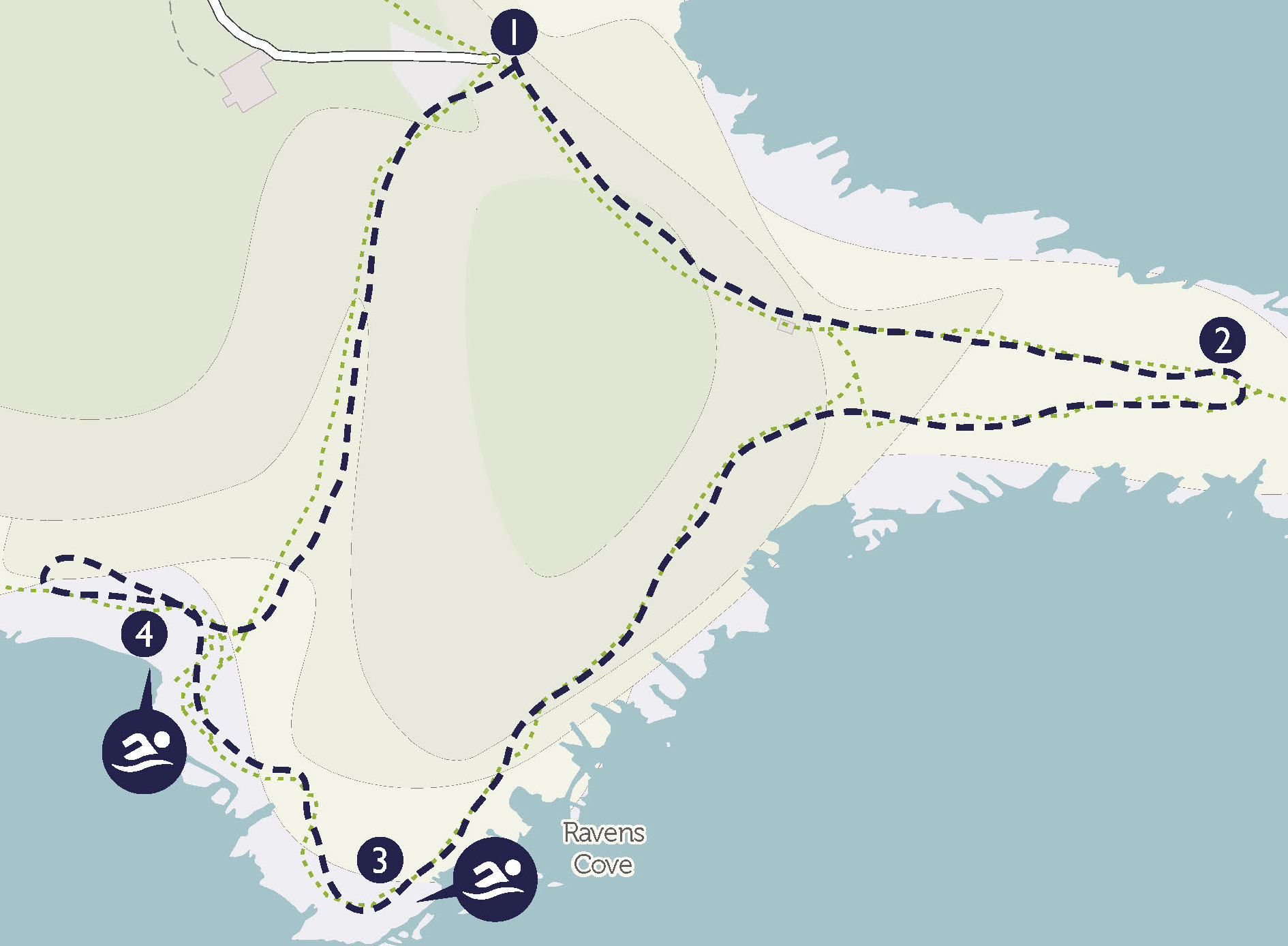
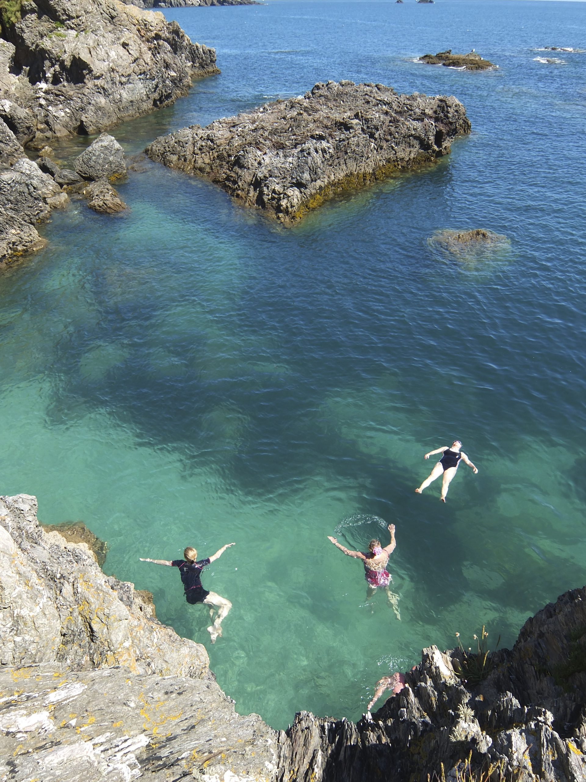
START POINT CIRCULAR
A wonderful wild adventure past a Gothic lighthouse and across a dramatic headland, before dropping down to swim at a secret beach.

INFORMATION
Distance: 2 miles
Time: 2-3 hours
Map: OS Explorer South Devon OL20
Start Point: Start Point car park (SX 820 375, TQ7 2ET)
End Point: Start Point car park
Public transport: The number 3 bus between Dartmouth and Plymouth stops at Stokenham, from where you would need to get a taxi to the start
Swimming: The hidden beach at Peartree Point (SX 819 366), and Great Mattiscombe Sands (SX 816 369).
Places of interest: Start Point Lighthouse.
Refreshments: The Start Bay Inn at Torcross is a thatched pub dating back to the 14th century, serving famous fish and chips and seafood specialities with stunning views across Slapton Sands and the bay (01548 580553, TQ7 2TQ). The Millbrook Inn at South Pool is a friendly and fun hostelry serving delicious pub grub and with a 24-hour produce shop operated on an honesty system (01548 531581, TQ7 2RW)

DIRECTIONS
1. The walk begins in the pay car park at Start Point, which is worth every penny for the incredible views alone. Head out through the gate or over the stile and follow the Coast Path down the old lighthouse road towards the sea, until you reach the lighthouse. (0.6 miles)
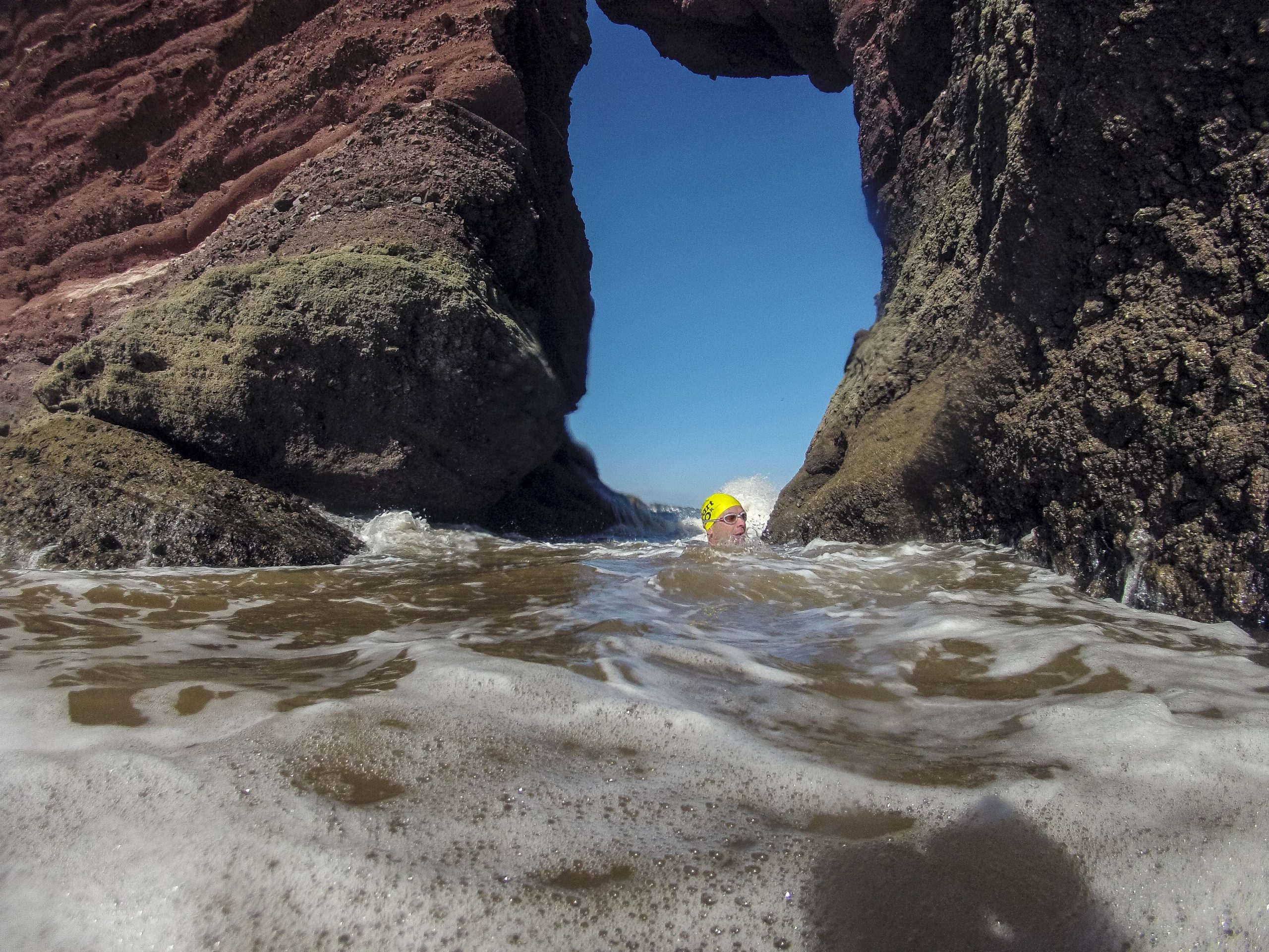
2. After visiting the lighthouse, continue to follow the coast path west along the cliffs until you reach the small headland of Peartree Point. Here you can climb down to the secret shingle beach and swim spot. Do stay close to the coast when swimming as there are some strong currents further out near the larger rocky islands. (0.7 miles)
3. From Peartree Point, continue to the west along the coast path to Great Mattiscombe Sand, walking down the steps to the beach. (0.3 miles)
4. Follow the track uphill from the beach and through several gates to return to the car park half a mile away. (0.4 miles)
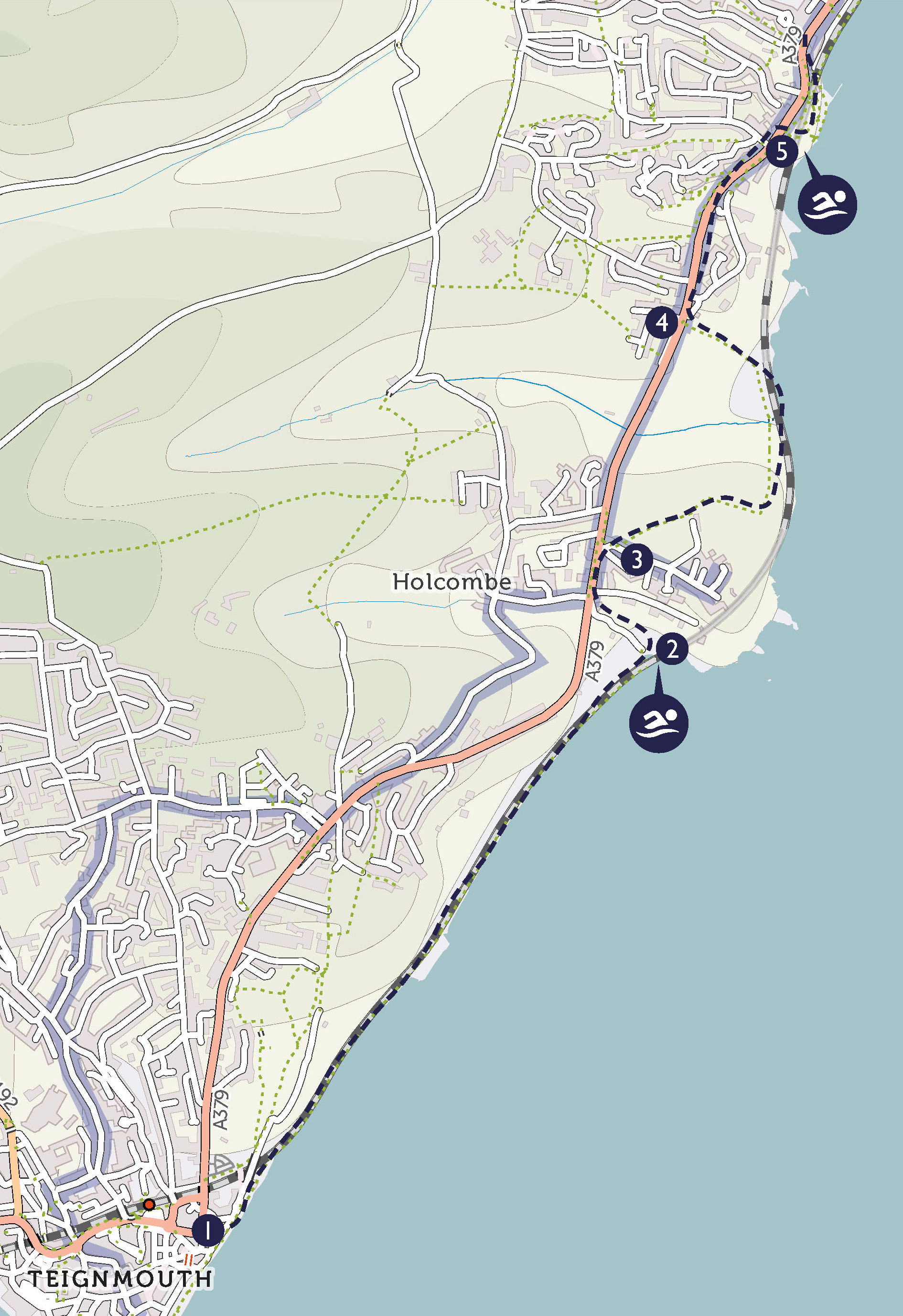
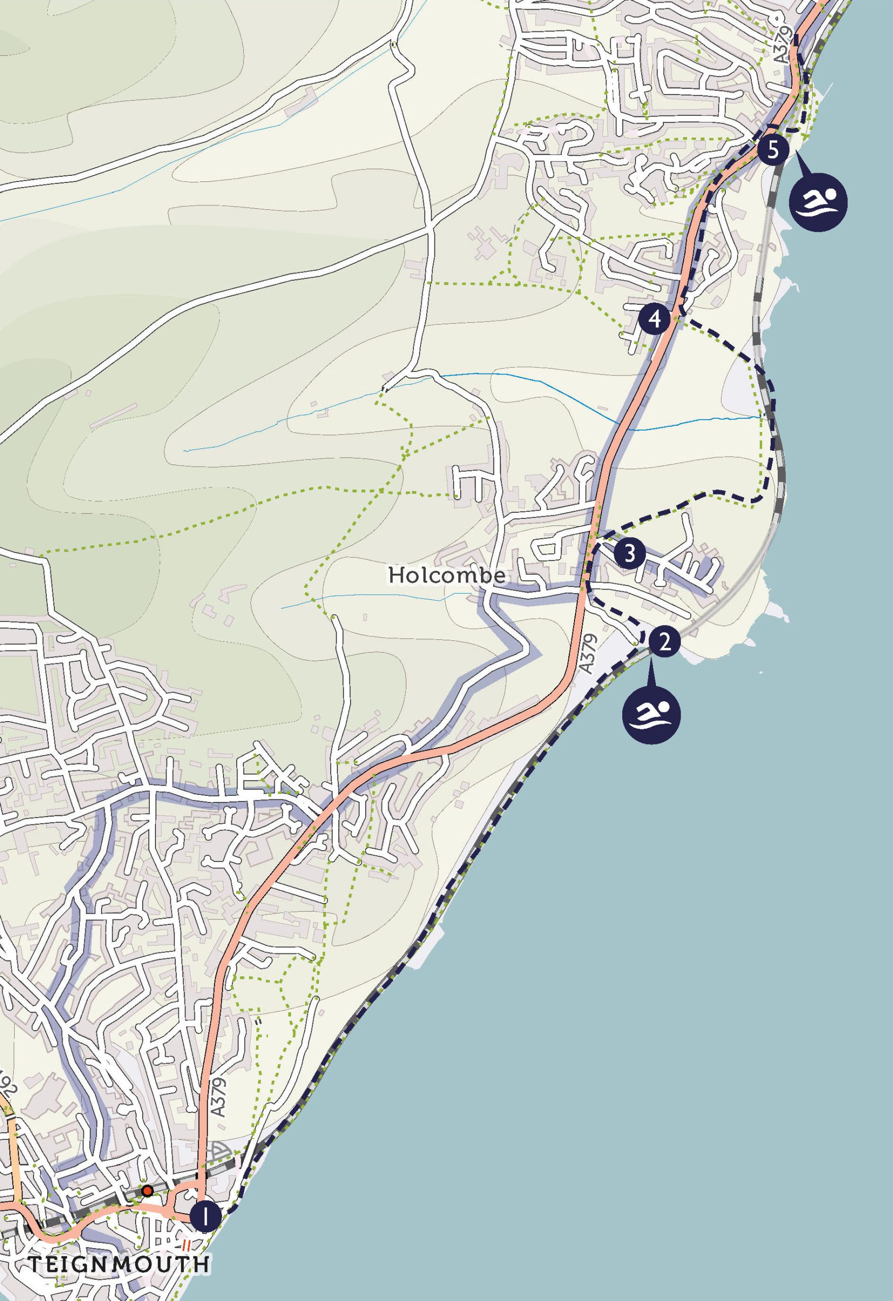
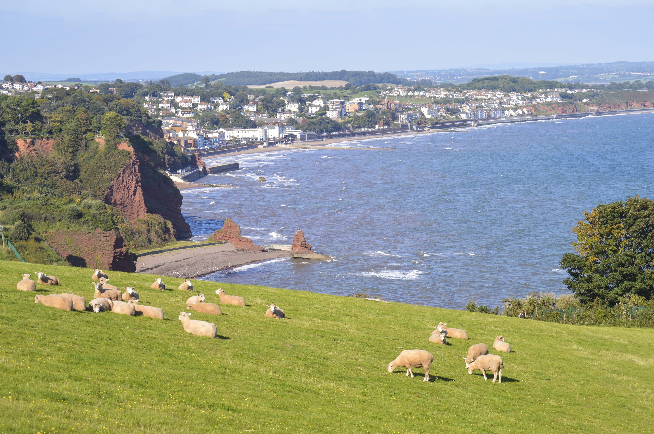
TEIGNMOUTH TO DAWLISH RAILWAY WALK
A stunning walk taking in Brunel’s world-famous coastal stretch of railway, as well as the famous red cliffs of South Devon.
INFORMATION
Distance: 3 miles (or 6 miles depending on whether returning by train)
Time: 2-3 hours
Map: OS Explorer, Teignmouth and Dawlish OL44
Start Point: Teignmouth Pier (SX 941 727, TQ14 8BB); parking on the seafront and in numerous car parks
End Point: Teignmouth Pier
Public transport: Teignmouth is served by train and buses including the Number 2 from Exeter and the 184 and 186 from Newton Abbot
Swimming: Holcombe Beach (the Parson and Clerk) (SX 957 746), Coryton Cove (SX 961 760)
Places of interest: Teignmouth, Teignmouth Pier, The Riviera Line railway, the Parson and Clerk, Dawlish
Refreshments: The Eastcliff Café in Teignmouth is perfectly placed on the seafront (01626 777621, TQ14 8SH) with nice hot food including bacon baps, chips and teacakes. For a seafood extravaganza head to the Crab Shack (booking essential) (01626 777956, TQ14 8BY). In Dawlish, Gay’s Creamery is an institution, serving pasties and ice creams (01626 863341, EX7 9PD).

DIRECTIONS
1. Walk north along the promenade from the pier with the sea on your right, and continue past Teignmouth Lido and the Teign Corinthian Yacht Club as the sea wall meets the railway. Continue past the enormous Teignmouth sign and on towards the railway tunnel. (1.4 miles)
2. Drop down onto the beach at one of the last sets of steps for the first swim at Hole Head near Parson’s Tunnel. After your swim, go back up the steps and under the archway onto Smugglers Lane. Walk up the steep hill to the main road. Carefully cross the busy road and turn right along the pavement. At the coast path sign, cross back over the road to turn right onto Windward Lane. (0.3 miles)
3. After a short distance, turn left to join the South West Coast Path. Follow the path around the back of Hole Head and down the steep hill to join the railway again. Cross over the small bridge and then up the hill and out to the road again. (0.7 miles)
4. Walk up the wooden steps onto the road. Turn right to follow the old Teignmouth Road and past some rather nice houses. Turn right into Lea Mount Gardens and follow the path left and down out of the gardens. Turn right at the fork and wind down the cliffs, turning right again to get to Coryton’s Cove. (0.4 miles)
5. After a swim, follow the path past the beach café and beach huts and around the corner past Cowhole Rock and the breakwater to again join the railway line. Continue along the sea wall, left under the railway arch and then right along to the station. Cross over the tracks for the return train journey to Teignmouth. There are about four trains per hour at peak times and one each hour off-peak. (0.5 miles)
6. To return to the pier in Teignmouth, walk straight out of the station, cross the road and walk down Station Road. Cross the road and onto the Triangle. Bear right and then cross the road at the new Pavilions art centre. Turn right and then left at the Tourist Information Centre to walk between the bowling club and the Den to reach the pier. (0.2 miles)
For more coastal walks, click here or pick up a copy of the magazine.
TOP OFFER
Details on all these swims are available in Wild Swimming Walks Dartmoor and South Devon: 28 Lake, River and Beach Days Out in South West England by Sophie Pierce and Matt Newbury (£14.99, Wild Things Publishing), which is available from all good bookshops. For 30 per cent off and free P+P visit wildthingspublishing.com and enter ‘Coast’ as your coupon code.
Sophie Pierce and Matt Newbury, authors of new book Wild Swimming Walks: Dartmoor and South Devon, share their favourite walks with a wild swim spot on the south Devon coast
CELLAR BEACH CIRCULAR
This is a simply gorgeous walk and swim, taking in huge and rugged cliffs, with vertiginous and far-reaching views, as well as the softer scenery of the Yealm estuary.

INFORMATION
Distance: 4.5 miles
Time: 2 hours
Map: OS Explorer South Devon OL20
Start Point: Car park by the tennis courts in Noss Mayo (PL8 1EH, SX 547 474)
End point: Car park by the tennis courts in Noss Mayo
Public transport: Number 94 Bus from Plymouth. Mon-Sat
Swimming: Cellar Beach (SX 531 475) River Yealm estuary at Kilpatrick Steps (SX 540 477)
Places of Interest: Revelstoke Drive, Cellar Beach which is sandy at low tide
Refreshments: The Ship Inn, Noss Mayo has a lovely setting overlooking the harbour with wooden floors and log fires in winter. It also has fun, clear ‘pods’ you can sit in outside, enjoying the views while staying warm (01752 872387, PL8 1EW). Also the Swan Inn (01752 872392, PL8 1EE). At low tide you can walk across to the Dolphin Inn in Newton Ferrers (01752 872007, PL8 1AE)

DIRECTIONS
1. From the car park, turn left up the lane, with the houses on your right. (0.1 miles)
2. The lane turns into a track. There is a sign saying No Through Road; keep following the track. (0.5 miles)
3. After about 20 minutes the path hits a road, you will see a gate straight ahead with a sign saying Coastal Footpath and Worswell Farm. Turn left along the road and soon right by a car park. There is a sign saying Public Footpath / Coast Path. You get to a gate which says Keep Dogs Under Control – go through here, turn right and follow the coast path west with the sea on your left. (0.5 miles)
4. Follow the path past Warren Cottage, and keep going. (0.7 miles)
5. Follow the path around the headland at the mouth of the estuary and follow it into the woods with the estuary on your left. (0.2 miles)
6. Once out of the woods, you pass a valley with fields and a stream on your left, and then get to some cottages on your right. (0.5 miles)
7. It is easy to miss the turning down to Cellar Beach. It’s on the left, opposite a large Arts and Crafts style house, which has a weather vane with a ship on it. There is a small wooden sign with the yellow National Trust acorn on it, saying Cellar Beach. Take this left hand turning off the main path and follow it down to the beach. (670 ft)
8. Coming back up from the beach, turn left at the Arts and Crafts house and follow the path. Just past the gate and a parking area on the left, there’s a path to the left going down into the woods. Take this path. (0.2 miles)
9. Follow the path behind the cottages and the Toll House and past Kilpatrick Steps (another swim spot). Keep going and you will pick up a road which takes you along the estuary and back to the village. (1.1 miles)
BANTHAM TO THURLESTONE CIRCULAR
This short walk takes in abundant wildlife, magnificent cliff-top views and a selection of beaches perfect for dippers or more serious swimmers.

INFORMATION
Distance: 4 miles
Time: 3–4 hours
Map: OS Explorer South Devon OL20
Start Point: Bantham car park (SX 663 436, TQ7 3AN)
End point: Bantham car park
Public transport: Seasonal passenger ferry to Bigbury. Nearest train stations are Totnes (17 Miles) or Ivybridge (14 Miles). There are no buses to Bantham, but you can reach Thurlestone on the 162 Tally Ho! service which runs from Kingsbridge
Swimming: Bantham Sands (SX 662 437), South Milton Sands (SX 676 417), Leas Foot Sand (SX 673 421)
Places of Interest: Bantham Village, Thurlestone Village, Thurlestone Arch
Refreshments: The Beach House at South Milton Sands does amazing seafood but is always busy so best to book (01548 561144, TQ7 3JY). The Sloop at Bantham is a comfy pub with good food (01548 560489, TQ7 3AJ). You can also eat at the Village Inn in Thurlestone which makes a good stop ¾ of the way round (01548 563525, TQ7 3NN), and there is the brilliant Gastrobus in the car park at Bantham which does a great line in quality ‘fast food’ (07592 811277, TQ7 3AN)
DIRECTIONS
1. From the bottom left hand corner of Bantham Sands car park take the road towards the beach and the Surf Life Saving Club, forking left at the bottom to go through the kissing gate and onto the South West Coast Path. It is signed for Thurlestone. Climb the slope and follow the path up to the point. (0.3 miles)
2. Follow the path along the cliff top. You go past several beaches which are swimmable, and then past the golf course on your left. (1.4 miles)
3. At Leas Foot Sand keep going along the coast path with the sea on your right, past the large block of apartments and then down to South Milton Sands for a swim and picnic. On a calm day and at high tide, some swimmers like to try and swim through the rock arch. The arch also marks the end of a reef that runs parallel to the shore which is great for snorkelling. (0.3 miles)
4. From South Milton Sand, return to the start of Leas Foot Sand and then turn right up the sand path, through the overflow parking field and left into the main golf club car park. Continue up onto the road to Thurlestone past the golf club and tennis courts on your left. Continue up the hill to the war memorial, perhaps pausing in the village for refreshments. (0.9 miles)
5. At the war memorial leave the road and continue straight on along a track signed Public Footpath Bantham 3/4 mile. Follow the waymarked path through several fields before descending steeply into the valley. After two stiles you will eventually come out onto the lane in Bantham, near the Sloop Inn. Follow the lane back down to the car park. (0.9 miles)
START POINT CIRCULAR
A wonderful wild adventure past a Gothic lighthouse and across a dramatic headland, before dropping down to swim at a secret beach.

INFORMATION
Distance: 2 miles
Time: 2-3 hours
Map: OS Explorer South Devon OL20
Start Point: Start Point car park (SX 820 375, TQ7 2ET)
End Point: Start Point car park
Public transport: The number 3 bus between Dartmouth and Plymouth stops at Stokenham, from where you would need to get a taxi to the start
Swimming: The hidden beach at Peartree Point (SX 819 366), and Great Mattiscombe Sands (SX 816 369).
Places of interest: Start Point Lighthouse.
Refreshments: The Start Bay Inn at Torcross is a thatched pub dating back to the 14th century, serving famous fish and chips and seafood specialities with stunning views across Slapton Sands and the bay (01548 580553, TQ7 2TQ). The Millbrook Inn at South Pool is a friendly and fun hostelry serving delicious pub grub and with a 24-hour produce shop operated on an honesty system (01548 531581, TQ7 2RW)

DIRECTIONS
1. The walk begins in the pay car park at Start Point, which is worth every penny for the incredible views alone. Head out through the gate or over the stile and follow the Coast Path down the old lighthouse road towards the sea, until you reach the lighthouse. (0.6 miles)
2. After visiting the lighthouse, continue to follow the coast path west along the cliffs until you reach the small headland of Peartree Point. Here you can climb down to the secret shingle beach and swim spot. Do stay close to the coast when swimming as there are some strong currents further out near the larger rocky islands. (0.7 miles)
3. From Peartree Point, continue to the west along the coast path to Great Mattiscombe Sand, walking down the steps to the beach. (0.3 miles)
4. Follow the track uphill from the beach and through several gates to return to the car park half a mile away. (0.4 miles)
TEIGNMOUTH TO DAWLISH RAILWAY WALK
A stunning walk taking in Brunel’s world-famous coastal stretch of railway, as well as the famous red cliffs of South Devon.

INFORMATION
Distance: 3 miles (or 6 miles depending on whether returning by train)
Time: 2-3 hours
Map: OS Explorer, Teignmouth and Dawlish OL44
Start Point: Teignmouth Pier (SX 941 727, TQ14 8BB); parking on the seafront and in numerous car parks
End Point: Teignmouth Pier
Public transport: Teignmouth is served by train and buses including the Number 2 from Exeter and the 184 and 186 from Newton Abbot
Swimming: Holcombe Beach (the Parson and Clerk) (SX 957 746), Coryton Cove (SX 961 760)
Places of interest: Teignmouth, Teignmouth Pier, The Riviera Line railway, the Parson and Clerk, Dawlish
Refreshments: The Eastcliff Café in Teignmouth is perfectly placed on the seafront (01626 777621, TQ14 8SH) with nice hot food including bacon baps, chips and teacakes. For a seafood extravaganza head to the Crab Shack (booking essential) (01626 777956, TQ14 8BY). In Dawlish, Gay’s Creamery is an institution, serving pasties and ice creams (01626 863341, EX7 9PD).

DIRECTIONS
1. Walk north along the promenade from the pier with the sea on your right, and continue past Teignmouth Lido and the Teign Corinthian Yacht Club as the sea wall meets the railway. Continue past the enormous Teignmouth sign and on towards the railway tunnel. (1.4 miles)
2. Drop down onto the beach at one of the last sets of steps for the first swim at Hole Head near Parson’s Tunnel. After your swim, go back up the steps and under the archway onto Smugglers Lane. Walk up the steep hill to the main road. Carefully cross the busy road and turn right along the pavement. At the coast path sign, cross back over the road to turn right onto Windward Lane. (0.3 miles)
3. After a short distance, turn left to join the South West Coast Path. Follow the path around the back of Hole Head and down the steep hill to join the railway again. Cross over the small bridge and then up the hill and out to the road again. (0.7 miles)
4. Walk up the wooden steps onto the road. Turn right to follow the old Teignmouth Road and past some rather nice houses. Turn right into Lea Mount Gardens and follow the path left and down out of the gardens. Turn right at the fork and wind down the cliffs, turning right again to get to Coryton’s Cove. (0.4 miles)
5. After a swim, follow the path past the beach café and beach huts and around the corner past Cowhole Rock and the breakwater to again join the railway line. Continue along the sea wall, left under the railway arch and then right along to the station. Cross over the tracks for the return train journey to Teignmouth. There are about four trains per hour at peak times and one each hour off-peak. (0.5 miles)
6. To return to the pier in Teignmouth, walk straight out of the station, cross the road and walk down Station Road. Cross the road and onto the Triangle. Bear right and then cross the road at the new Pavilions art centre. Turn right and then left at the Tourist Information Centre to walk between the bowling club and the Den to reach the pier. (0.2 miles)
For more coastal walks, click here or pick up a copy of the magazine.
TOP OFFER

Details on all these swims are available in Wild Swimming Walks Dartmoor and South Devon: 28 Lake, River and Beach Days Out in South West England by Sophie Pierce and Matt Newbury (£14.99, Wild Things Publishing), which is available from all good bookshops. For 30 per cent off and free P+P visit wildthingspublishing.com and enter ‘Coast’ as your coupon code.