Join WILLIAM THOMSON on his journey each month exploring a Shipping Forecast region.
Last month we learned how the shocking wreck of the steam clipper Royal Charter inspired Admiral Robert Fitzroy to begin work on what we now know as the Shipping Forecast. In addition to the loss of 450 lives aboard that one ship, a further 300 people died in the storm and 150 ships were sunk around the British Isles in the hurricane force winds.
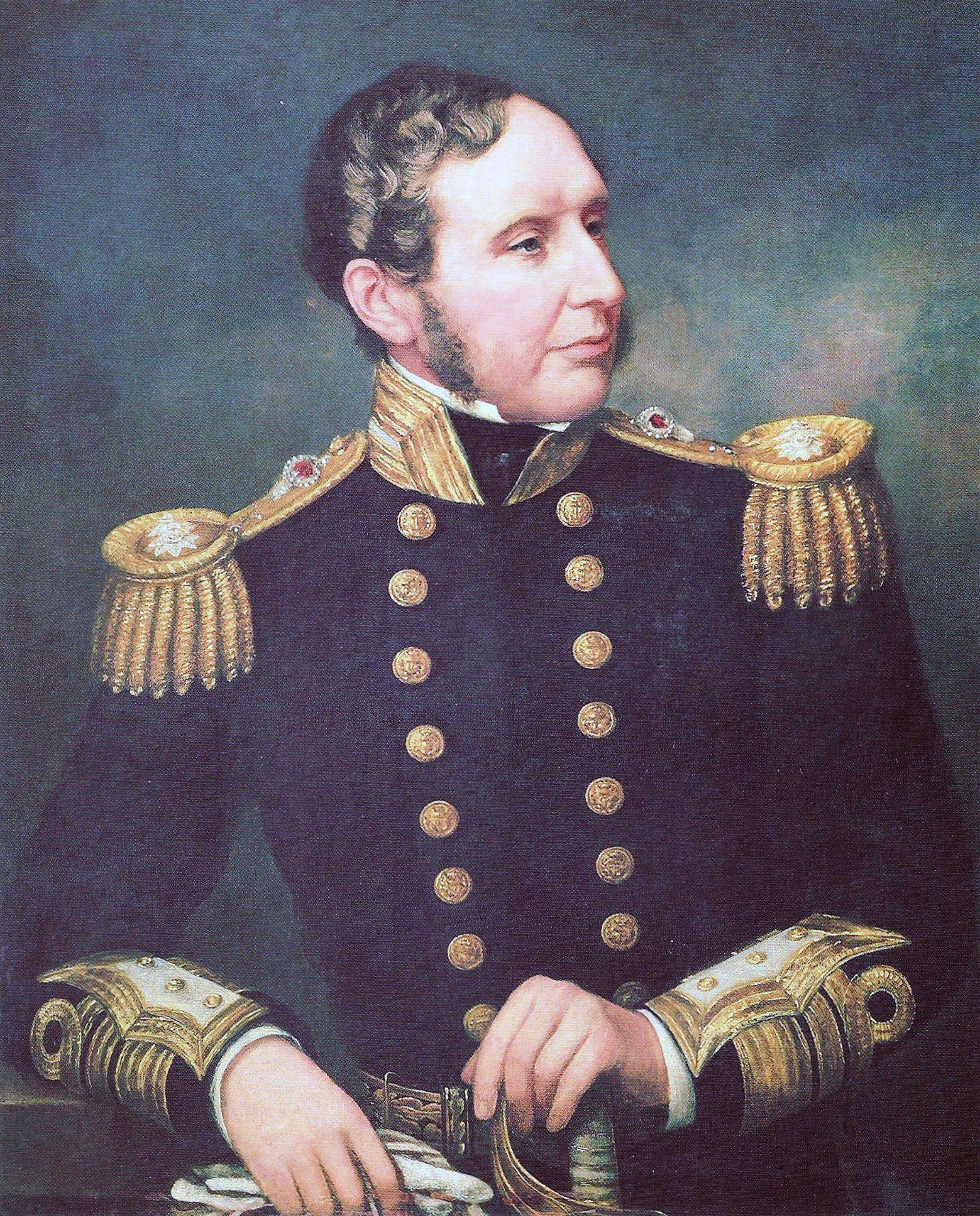
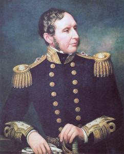
Something had to be done and Fitzroy was the man to do it. Born into aristocracy – he was the fourth grandson of King Charles II – while his status definitely helped him in life, what made him stand out was an incredible intelligence, combined with a strong sense of responsibility to help others.
At the age of 12 Fitzroy joined the navy and he was the first person to achieve 100 per cent in his lieutenant exam. Stationed aboard HMS Beagle on its mission to survey Tierra del Fuego (near Cape Horn), he took command of the ship when the captain, Pringle Stokes, took his life from depression and the strain of the job in terrible conditions. Fitzroy performed his task so diligently after Stokes’ demise that after the voyage he was given another special mission to survey South America and make new charts.
Well aware of the loneliness – and his own battles with depression – Fitzroy asked his friend Charles Beaufort (famous for the Beaufort Scale) to find a young gentleman to be his guest for the voyage; someone he could converse with in the evenings, free from the rigid social hierarchy of naval discipline.
Beaufort chose a 23-year-old naturalist, Charles Darwin. The voyage took them five years and provided the inspiration for Darwin’s work, while also establishing Fitzroy as a brilliant meteorologist. Upon returning home, his skills were well recognised and he was appointed chief of a new department, the Meteorological Statist to the Board of Trade, later condensed to the Met Office.
His task was to collect weather data at sea and he did this by arranging with ships’ captains to provide information of their surroundings using instruments on loan to them. Taking this information, he developed strategies to make weather data accessible to sailors and fishermen around the British Isles, bringing together the latest technologies of the time.
As we will explore in this series, he devised warning cones around the coast, installed barometers in fishing ports and published weather forecasts in the The Times newspaper. Sadly, he died before the first radio Shipping Forecast was broadcast in 1867.
You cannot underestimate the significance of Robert Fitzroy to the Shipping Forecast. Before him, there literally was no forecast – he is actually the one who coined the term. But for his genius and hard work he paid a high price, investing his entire fortune on developing the system to help others. In the end he took his own life, some say after publishing a faulty forecast. In a modern world where public figures often look after themselves foremost, Fitzroy was the epitome of a public servant.
And he got his recognition; in 2002 Finistèrre (an 80,000 square mile region off north-west Spain) was renamed Fitzroy, so his name will forever be connected to the Shipping Forecast.
The change came after an international dispute; Spain also have their own Shipping Forecast and a smaller region is called Finistèrre. To avoid confusion, they appealed to the World Meteorological Organisation for Britain to change the name. This was agreed, with Fitzroy being a natural choice.
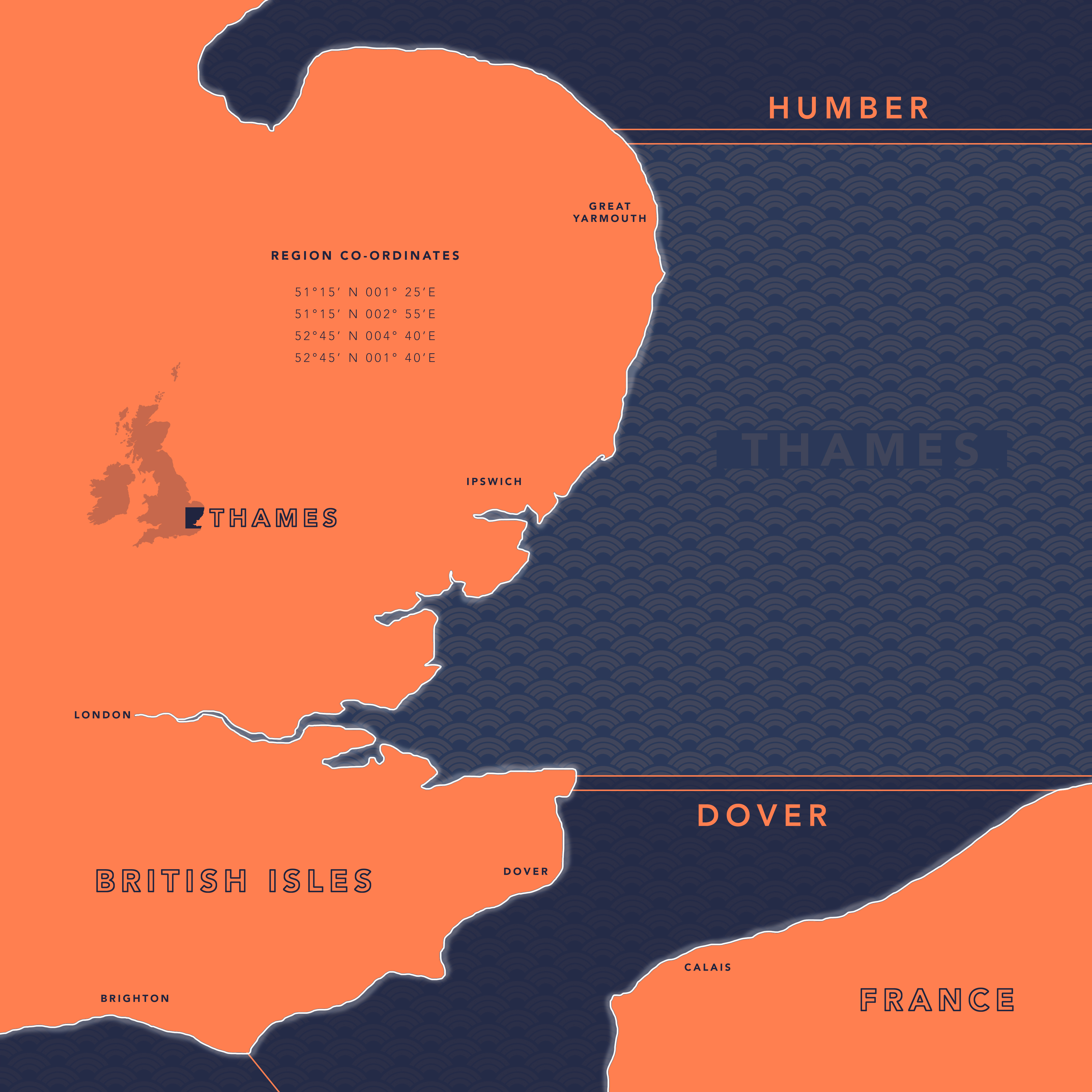
This is the only region named after a person; all the others are named from geographical features; Thames and Humber are rivers, Portland and Malin are headlands, Wight and Lundy are islands. We are exploring these magical places throughout this series, focusing this month on Britain’s best known river – the Thames.
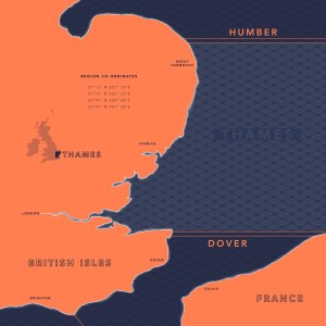
Thames. Southeasterly veering to southerly later, 2 to 3. Slight or moderate. Occasional rain, fog patches. Poor, occasionally very poor.
What does this mean?
Last month we learnt what ‘backing’ means – veering is the opposite. If a wind is veering it means it’s moving clockwise (when you look down at a wind chart). On the beach or at sea, this means that when you are facing into the wind now, it will soon be moving around to your right. At Force 3 it will be a gentle breeze, no more than 10 knots. You might see wavelets and the occasional white horse, but things will be mellow.
The one thing to look out for is visibility. There is a lot of moisture in the air, as evidenced by the warning of rain and fog. Technically, fog is a low cloud that reduces visibility to less than 1,000 metres and it can completely blanket you and make it very dangerous for two reasons.
Firstly, if you’re kayaking or paddleboarding and you have no compass or navigational equipment, you could lose your bearings completely. If you’re in a small boat this is less likely because you’ll have more kit onboard, but with all the shipping around there’s a chance of colliding with a bigger boat.
So play it safe and keep a thorough lookout both on radar and AIS – or don’t go out at all!
What’s the conditions for Thames today? Tune into the Shipping Forecast at 0048, 05:20, 12:01 or 1754 to find out!
THAMES SIGHTSEEING TOUR
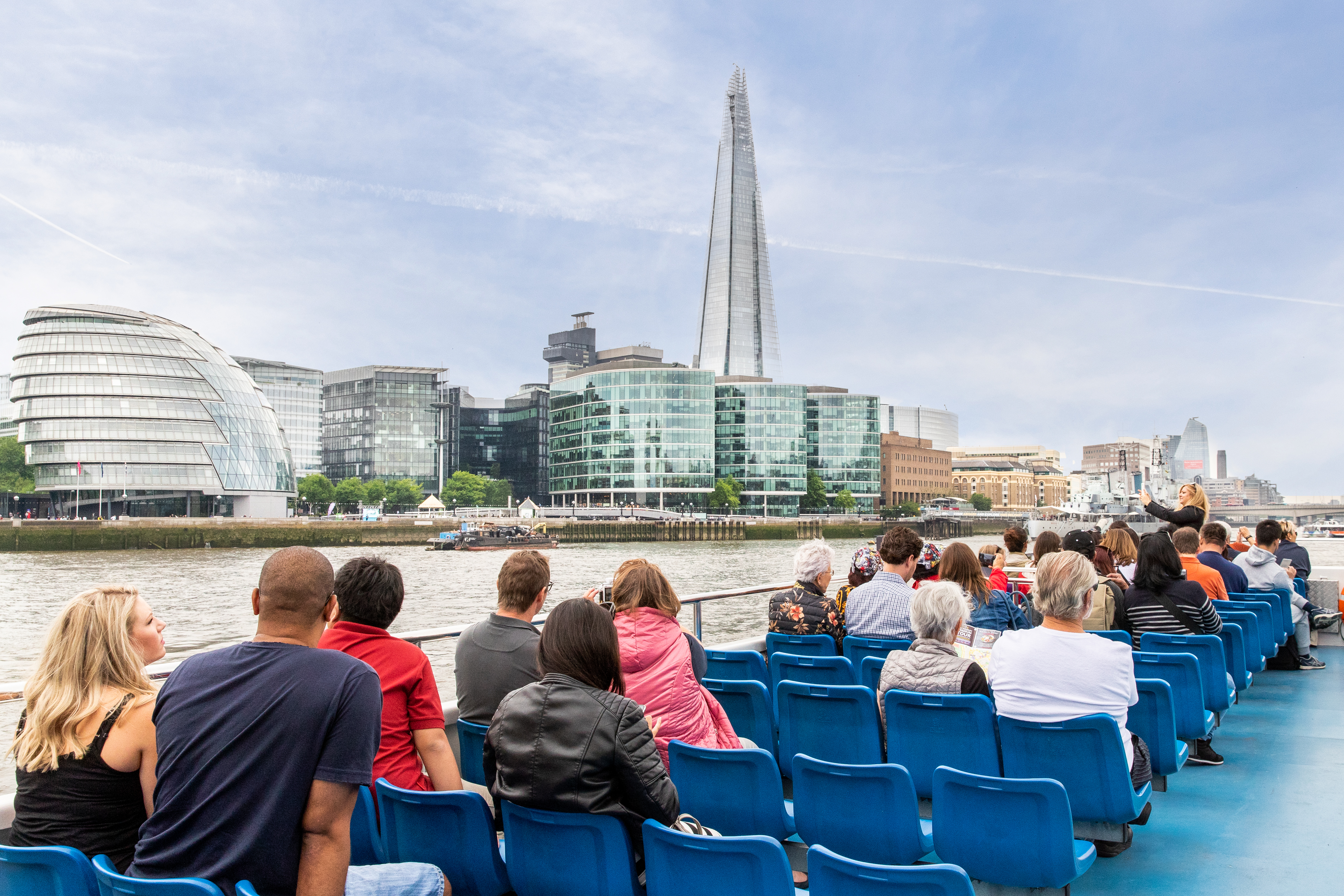
Last summer, I treated myself to a day exploring the library at the Maritime Museum in Greenwich. After filling my brain with knowledge about natural navigation, I wandered down to the river, past the awe-inspiring Cutty Sark, and stepped aboard the first riverboat heading upstream into central London.
Before I go on, I should add that there are two faults in my description here. Firstly, the Thames is not your average river that simple flows down to the sea; it is tidal, which means that when the tide is rising in the estuary it pushes currents up the river and the natural flow of the Thames is reversed. As a general rule, for just under half the time water in the Thames is flowing against gravity, up and inland.
The next wrong assumption I made when stepping aboard the riverboat was that it was your run-of-the-mill ferry boats taking you from A to B as fast as possible. Oh no, it was far more than that. I had inadvertently stepped aboard a Thames Sightseeing Tour; as soon as the engines fired up, our tour guide told us all about Greenwich, the Observatory, the Cutty Sark, and the fact that for just less than half the time currents in the Thames flow inland.
The knowledge was gratefully soaked up, perhaps because I was not expecting it. Either way, I had the most wonderful afternoon meandering upriver in the late afternoon sunshine, sitting on the top deck with wind gently blowing in my hair. It felt like being at sea, almost.
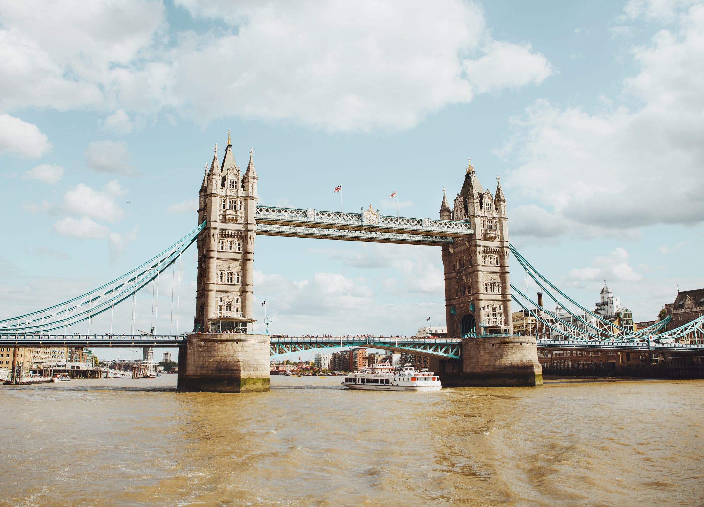
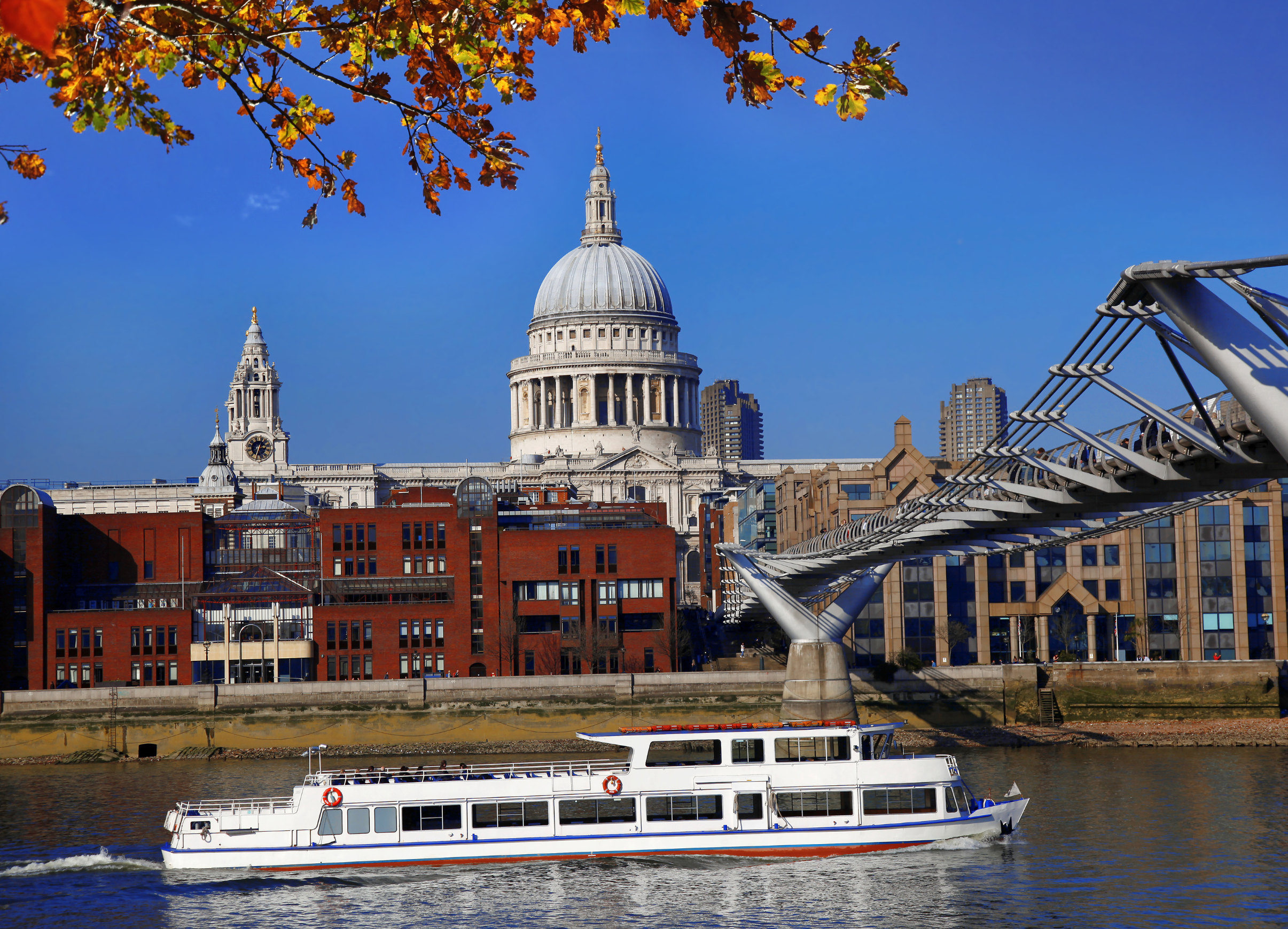
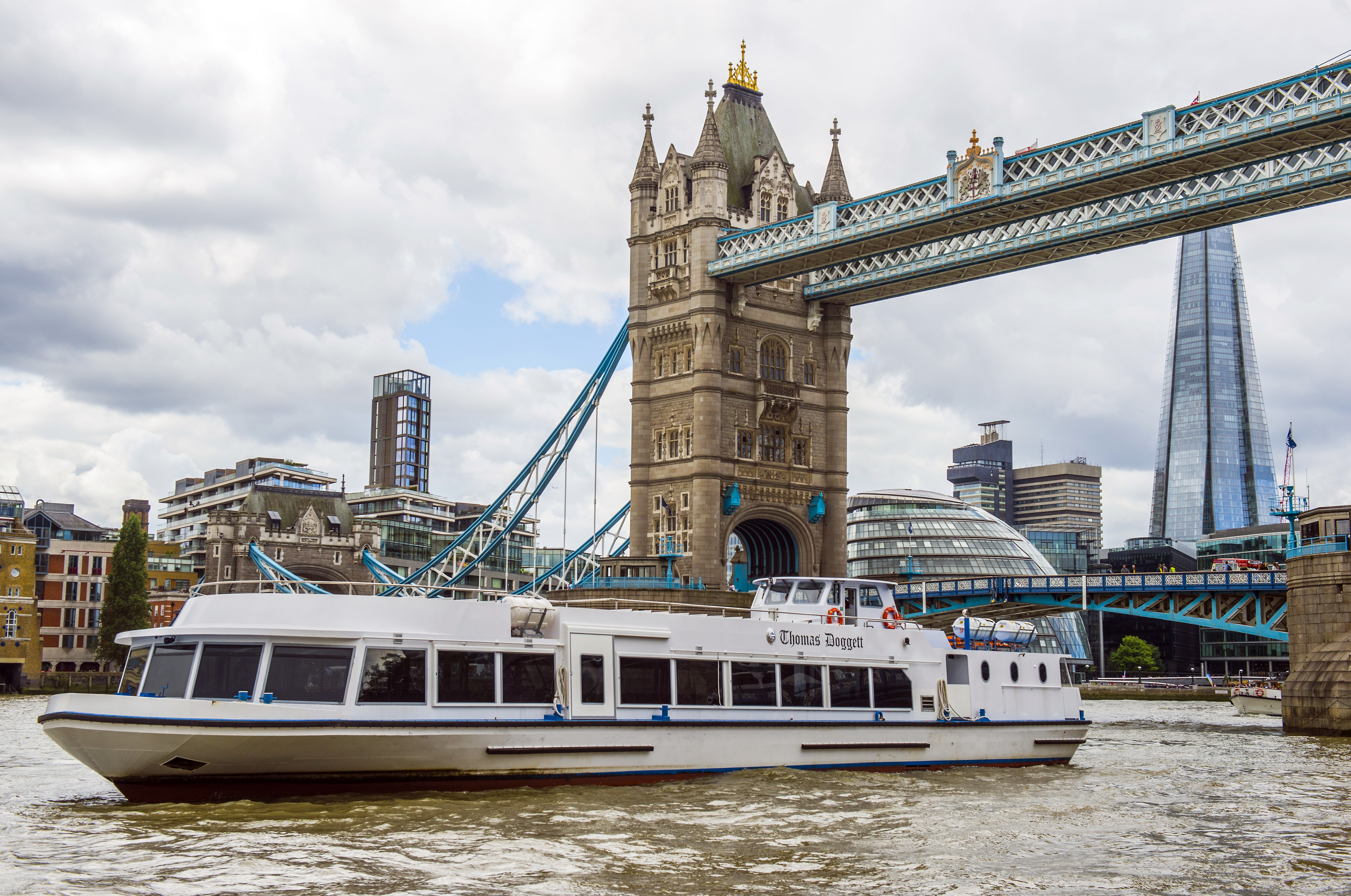
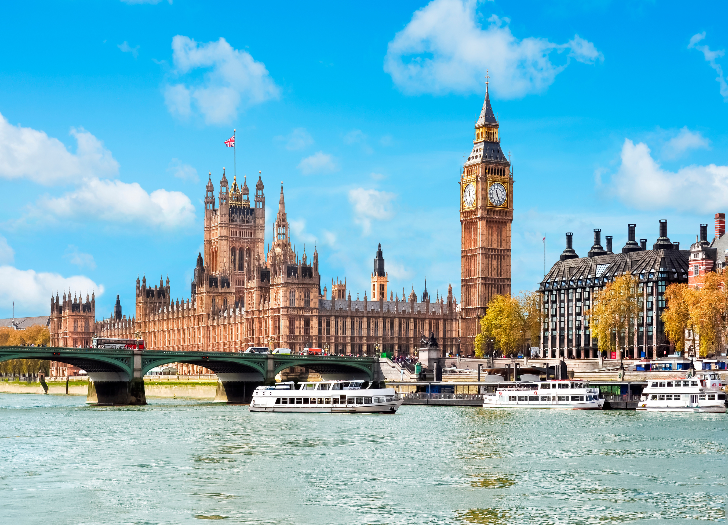
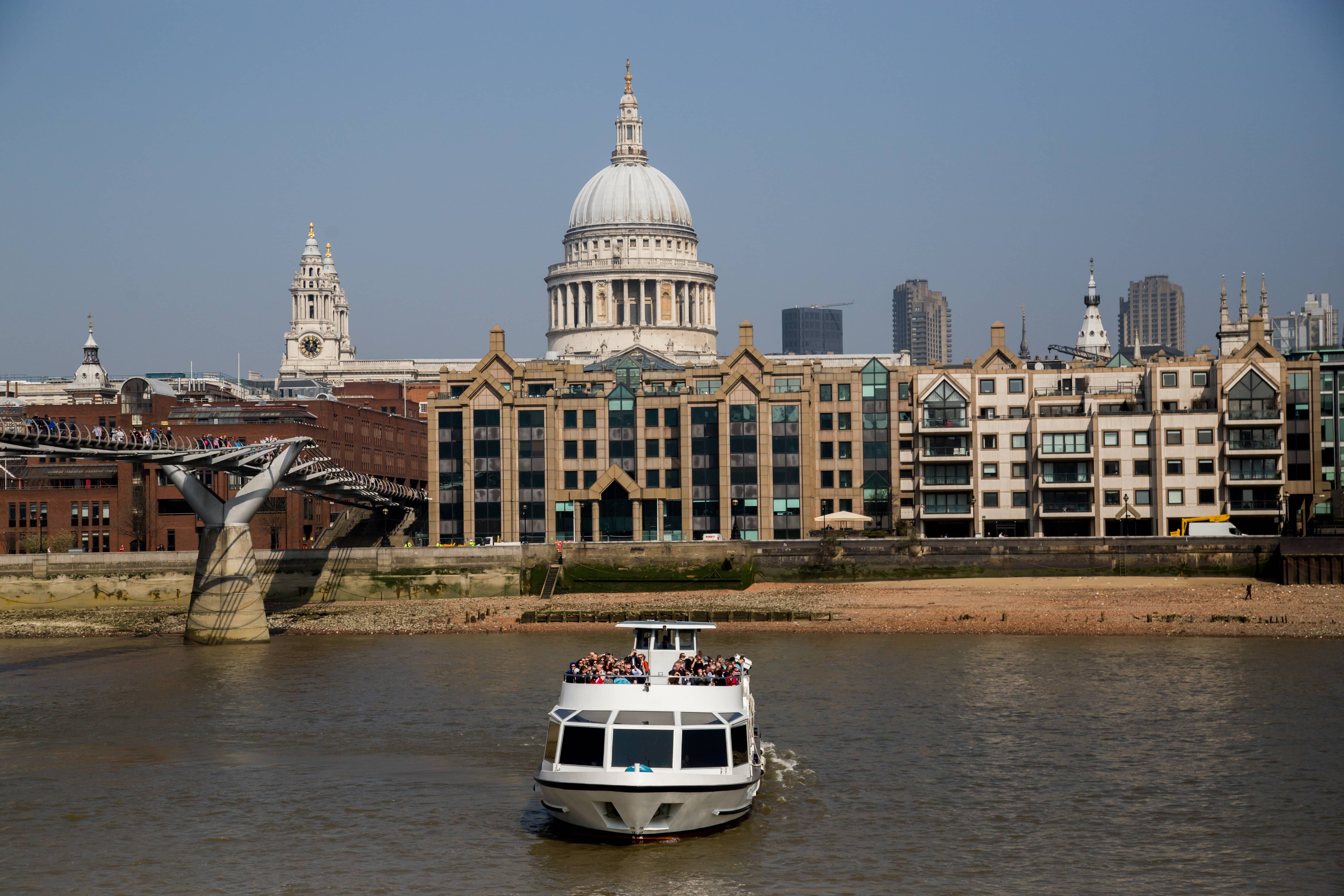
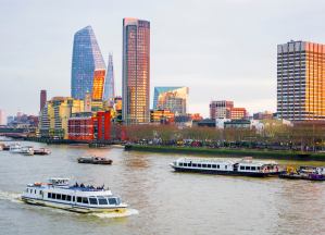
A stream of landmarks passed in our wake; St Paul’s Cathedral, the Millennium Bridge, Tate Modern, Shakespeare’s Globe, HMS Belfast, Tower Bridge, The Shard, Houses of Parliament. With each one our guide shared an insightful story, something I never knew about these iconic places in Britain’s identity.
The only downside to the trip was that I was late to my next engagement; we were consecutively overtaken by the speedy riverboats shuttling busy workers upriver, completely oblivious of the wonders around them that our tour guide was so vividly sharing.
Perhaps the best part of the sightseeing tour was seeing London in a completely different light. I have always thought of it as claustrophobic and detached from nature, far from the ebb and flow of the tide. But out there, in the wide river where water floods in from the North Sea, I enjoyed a sense of space and connection with the ocean.
After all, Greenwich is where many circumnavigations began, starting with a map and the idea of an epic voyage; around the Horn, into the ice, across the vast Pacific. A testament to this sense of adventure is the Greenwich meridian itself, the start of Longitude and a nod to our navigational heritage.
Check out William Thomson’s shipping forecast for The Hebrides here.